UNIGIS @GeoSmart India 2019, New Delhi
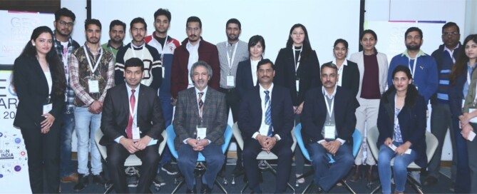
The UNIGIS International Association was invited to contribute to the GeoSmart India 2019 (GSI’19) conference held in New Delhi, India from 11th to 13th February 2019. GSI is the largest conference focussed on geospatial themes in the region. UNIGIS has been entrusted with a prominent role contributing as a knowledge partner to multiple activities over several years. Dr. Shahnawaz (Director, UNIGIS S/E Asia) coordinated and moderated a half day long ‘Geospatial Capacity Building Forum’ on 13th February, 2019. The forum attracted more than 60 delegates including students and academicians as well as industry and representatives of various organisations. The panel …
Read more…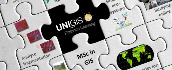
UNIGIS Salzburg: specialisation “GIS for the Environment”
UNIGIS Salzburg offers a new specialisation on GIS for the Environment. It is targeted at working professionals in the environmental or ecological domain, who want to acquire or deepen their GIS competences. A minimum of 12 ECTS is dedicated to the specialisation, which can be extended to 54 ECTS (including the Master Thesis). Students will gain competency in the following fields: Environmental monitoring – conceptualise environmental systems, identify adequate indicators, design a monitoring workflow, analyse and visualise system state changes. Spatial simulation of complex ecological systems – design, implement, analyse and validate spatially explicit simulation models to solve applied problems and …
Read more…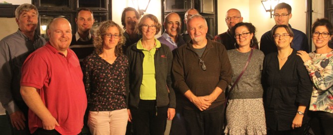
UNIGIS Annual Meeting in Hungary
The annual meeting of UNIGIS International Organization has been successfully concluded from October 26 to 28. The General Assembly is organized annually by a different member institution, this year the meeting was hosted by the Institute of Geoinformatics, Alba Regia Technical Faculty, Óbuda University. Mr. László Nádai, Vice-Rector and Dr. Lóránt Földváry, Deputy Dean welcomed the participants on behalf of Óbuda University. Subsequently, one of the first UNIGIS alumni in Hungary and now Leica’s Managing Director, László Gombás, presented the expected trends in data collection and processing. At the end of the first session, the UNIGIS International Association board of …
Read more…
Winners of the UIA Academic Excellence Prize 2018
The UNIGIS International Association (UIA) would like to announce the winners of its Academic Excellence Prize. The Prize, initiated in 2008, is presented to the student, or students, who submits the best MSc thesis (or paper) during the academic year and are nominated by their UNIGIS sites. In this year’s competition six excellent, high-quality MSc theses were considered by the Review Panel. The panel decided to propose three awards, including two winners of the Academic Excellence Prize for 2018: – Carrie Elizabeth Steves (UNIGIS USA; thesis “Trends in the Alaskan Bottom-Trawl Fishery from 1993 – 2015: A GIS-based Spatiotemporal Analysis”) …
Read more…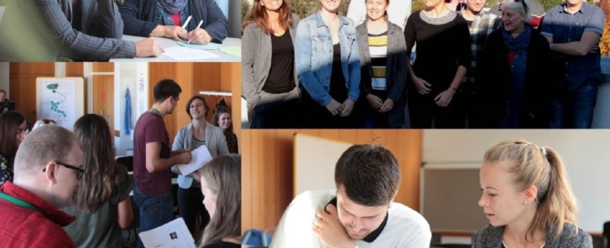
UNIGIS Salzburg: Intro Workshop for future GIS-professionals
For the October intake of the UNIGIS professional certificate course, 11 future GIS-professionals met in Salzburg for starting together into an intensive year of studying. With the exception of this introductory workshop UNIGIS professional is completely based on online distance learning: the programme consists of seven core modules plus electives with a total workload of 60 ECTS. The curriculum covers spatial data acquisition, modelling, management and visualisation as well as spatial analysis and application development. A great variety of real world exercises and assignments ensure the practical applicability of the learned concepts. The UNIGIS Salzburg team enjoyed the good atmosphere of …
Read more…
UNIGIS Salzburg news
2018 is a special year for Z_GIS, Interfaculty Department of Geoinformatics at the University of Salzburg and UNIGIS Salzburg: one highlight follows upon the next. The latest newsletter from UNIGIS Salzburg is focussing on these celebrations and events! UNIGIS offline: Z_GIS celebrating 30th anniversary Prof. Strobl, Head of department and UNIGIS Salzburg programme director is discussing the implementation of Z_GIS in comparison with developments in the field of GIS in the past three decades, with a special focus on UNIGIS Distance learning programmes, which have been a key component at Z_GIS for the last 25 years. Review: AGIT_30 AGIT, the …
Read more…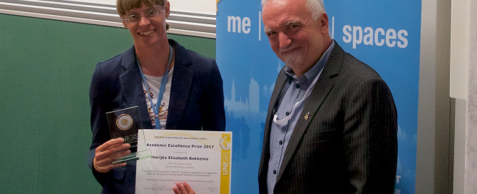
Marijke Bekkema receives UNIGIS Academic Excellence Prize @AGIT conference
“For my MSc thesis I chose a subject that matters a lot to me because it is happening in my backyard: agricultural intensification of grassland use which causes loss of biodiversity and specifically meadow bird decline.”, Marijke Bekkema, UNIGIS Amsterdam. Marijke Bekkema, UNIGIS Amsterdam alumni has been awarded the third place within the Academic Excellence Prize 2017. This annual Prize is awarded by UNIGIS International Association to students having submitted the best MSc theses during the previous academic year, accepted for graduation at one of the UNIGIS partner universities worldwide. In her thesis Marijke presented an elaborated methodology of using …
Read more…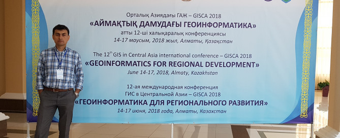
Geospatial Events Grant: Jafar Niyazov presenting at GISCA 2018
UNIGIS Bishkek graduate Jafar Niyazov has been awarded a Geospatial Events Grant within the second Call 2017 towards attending the GISCA. This Conference series and its publications are managed by the Austria-Central Asia Centre for GIScience – ACA*GIScience and supported by the Eurasia-Pacific Uninet and the Austrian Academy of Sciences’ Commission for GIScience. The 12th Central Asia GIS Conference – GISCA 2018 «Geoinformatics for Regional Development» took place at Al-Farabi Kazakh National University, Almaty, Kazakhstan from June 14-17 . Jafar Niyazov, researcher at the Institute of Water problems, hydropower and ecology Academy of Sciences of Tajikistan, completed his UNIGIS studies …
Read more…
u_Lecture webinars summer semester 2018
Starting from May, we are looking forward to an exciting roster of outstanding speakers on a range of topics covering themes of current interest for UNIGIS alumni, students, and everyone else. The open u_Lecture webinar series offers a LifeLongLearning opportunity to graduates and everyone keen to follow developments across the exciting field of Geoinformatics. See below for details on upcoming talks, and preview further speakers we keenly anticipate this term: >> Make sure you mark your calendars not to miss these unique opportunities to learn from and interact with these outstanding individuals! >> You can watch the recording of past …
Read more…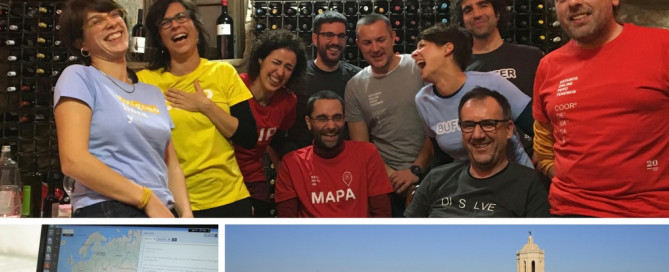
UNIGIS Girona celebrating its 20th anniversary!
Right from its beginnings, the GIS and Teledetection service (SIGTE http://www.sigte.udg.edu/) of the University of Girona embraced the UNIGIS Girona project, and has made it grow to what it is today. Getting this far has been an adventure in itself, a project of professional growth and personal experiences. However, UNIGIS Girona has reached the twentieth edition thanks to the contribution of each single person involved in the project: • almost 2000 alumni who trusted us and who paved their own way with our master’s degree; • tutors of the different modules; • contributors who have made possible the proper performance …
Read more… Previous Next