
 Starting from May, we are looking forward to an exciting roster of outstanding speakers on a range of topics covering themes of current interest for UNIGIS alumni, students, and everyone else. The open u_Lecture webinar series offers a LifeLongLearning opportunity to graduates and everyone keen to follow developments across the exciting field of Geoinformatics. See below for details on upcoming talks, and preview further speakers we keenly anticipate this term:
>> Make sure you mark your calendars not to miss these unique opportunities to learn from and interact with these outstanding individuals!
>> You can watch the recording of past u_Lecture webinars here > UIA webinar channel
June 25, 5:30pm CET >Register for recording
>Dr Mike Wood (Lecturer in Environmental Management, University of Salford): Chernobyl from above – using UAVs to study ecosystem recovery after a fire in the world’s most radioactive forest
On 26th April 1986, a fire at the Chernobyl Nuclear Power Plant led to the world’s worst nuclear disaster. People were forced to permanently leave the area due to the high levels of radioactive contamination in the environment, but the wildlife remain. Prof Mike Wood leads a team of scientists who are studying the Chernobyl environment using a variety of novel technologies, including motion-activated cameras, sound recorders and drones.
For decades the term ‘drone’ has been associated with Unmanned Aerial Vehicles (UAVs) used by the military for reconnaissance and attack applications. Over recent years, there has been a ‘drone revolution’, with declassified military technology paving the way for manufacturers around the world to develop a variety of drones for sale to the public. Many researchers are now using drones to take aerial photographs of their study sites, but the use of drones as a principal tool for research data collection is still in its infancy. A major challenge is the development of robust methodologies for drone based research. However, if such methodologies can be developed, drones provide an excellent opportunity to study difficult to access and/or hazardous locations.
In this u_Lecture, Mike will explain the evolution of the Chernobyl Exclusion Zone and the drone-based methods that his team have developed to quantify contamination distribution and vegetation growth in the world’s most radioactively contaminated terrestrial ecosystem.
The research discussed was conducted within TREE (http://tree.ceh.ac.uk/) (funded by NERC, Radioactive Waste Management Ltd. & the Environment Agency) and RED FIRE (https://www.ceh.ac.uk/redfire) (funded by NERC).
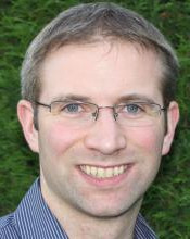 Bio: Professor Mike Wood is Chair in Applied Ecology at the University of Salford and Programme Leader for UNIGIS UK. A world-renowned radioecologist, Mike’s research has advanced the international environmental radiation protection system and facilitated its implementation in various countries around the world. He currently leads a 5-year research programme on the wildlife of the Chernobyl Exclusion Zone. Mike’s research has gained a high media profile internationally and featured in the popular BBC/PBS documentary about ‘Chernobyl’s Mega Tomb’. A well-known science communicator and regular keynote speaker, Mike’s wider public engagement activity has included technological innovations, such as enabling audiences to explore the Zone through Virtual Chernobyl. Mike’s standing within radiation protection has led to various national and international roles, including: Chair of the UK Government consultation on new radiation protection legislation (2016); Editorial Board of the Journal of Radiological Protection (since 2014); Member of Council and Trustee of the Society for Radiological Protection (since 2016); and various UN IAEA Working group roles (since 2006). His research and impact have been recognised through various awards including: the ‘Jack Martin Prize’ (2013) for outstanding academic excellence; the prestigious Times Higher Education (THE) Research Project of the Year award (2016) for “ground-breaking” research; and the Society for Radiological Protection Founders’ Medal (2017) for his role in advancing the science and practice of radiation protection internationally.
May 16, 5:30pm CET >Register for recording
>Dr Jonny Huck (Lecturer in Geographical Information Science, University of Manchester): “The Hammer of GIS”: Embracing Vagueness Participatory Mapping
One of the greatest challenges in GIS, and particularly Participatory GIS, is the representation of data that do not fit well into the normative point, line and polygon representations upon which GIS and related algorithms are often predicated. In spite of a broad understanding that these representations are incompatible with many types of data collected from the public, especially those relating to their spatial thoughts and feelings, many researchers still persist in using them. This frequently leads to a situation whereby the representation dictates the type of analysis, rather than the other way around. This webinar will explore this issue through an examination of recent research into conflict, segregation and ‘community belonging’ in Northern Ireland; and demonstrate the way in which novel methods and data models can avoid this situation, and so permit a greater level of insight into complex social phenomena.
 Bio: Dr Jonny Huck is a Lecturer in Geographical Information Science at the University of Manchester, specialising in the geospatial software development. Jonny is a fellow of Furness College at Lancaster University, the GIS Lead for the interdisciplinary Digital Humanities group at the University of Manchester, a member of the national steering committee for GIS Research UK and a member of the Research Approvals Group for the Consumer Data Research Centre.
More information on upcoming talks will be published soon!