Next Call for UNIGIS Geospatial Events Grants – GEG
Geospatial Events Grants Call 2017/2 – Now open for applications September 2017 “UNIGIS Geospatial Events Grants” The UNIGIS International Association is announcing the second call of the “Geospatial Events Grants” (GEG) funded by UNIGIS International Association and industry partners. Connecting active UNIGIS students with the international geospatial community and creating added value within the UNIGIS network are the objectives of the GEG. Participating in a leading Geospatial event will enhance the learning experience beyond lessons and exercises and is of course an excellent opportunity to establish new contacts with GIS experts from all over the world. The call considers the …
Read more…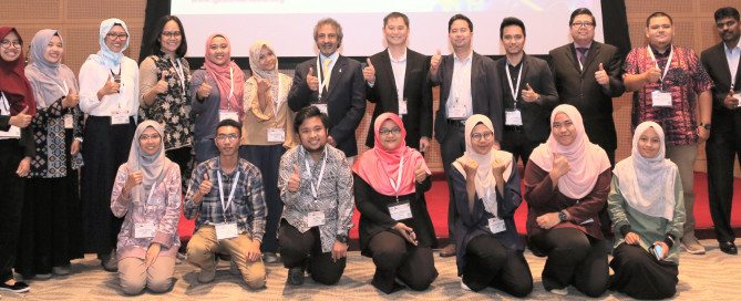
UNIGIS @ GeoSmart Asia 2017, Kuala Lumpur
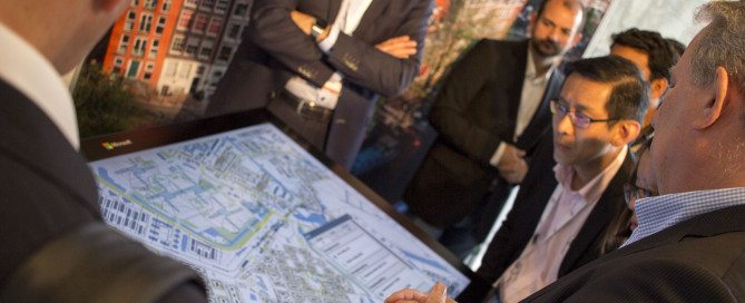
>UNIGIS was invited to contribute to the >GeoSmart Asia 2017 conference held in Putrajaya, Malaysia from August 22-24 and to organise the ‘Geospatial Youth Forum’ bringing academia, industry, organisations and students onto a common platform for promoting career-oriented face-to-face interaction. >GeoSmart Asia is one of the largest regional conferences focussed on geospatial themes in Asia and is being annually organised in countries across the region. UNIGIS has been entrusted with a prominent role of conducting Geospatial Capacity Building sessions since 2005 and this was the 15th continuous session coordinated by UNIGIS at this international event. Dr. Shahnawaz (Director, UNIGIS S/E …
Read more…
Rafael Beltran recognized as ‘UNIGIS International Fellow’
The board of the UNIGIS International Association (UIA) is honoured to announce the nomination of >Rafael Beltran Ramallo (Bolivia) as a Fellow. Above and beyond his roles as an instructor and consultant for the >UNIGIS Latin America programs, Rafael Beltran is a highly visible and acknowledged ambassador for UNIGIS and contributes through his active >social media presence. Congratulations to this distinction on behalf of the entire global UNIGIS community – we all are looking forward to continue working with you towards “Educating GIS Professionals Worldwide! “UNIGIS International Fellow” – it is a distinction awarded by the >UNIGIS International Association (UIA) for UNIGIS …
Read more…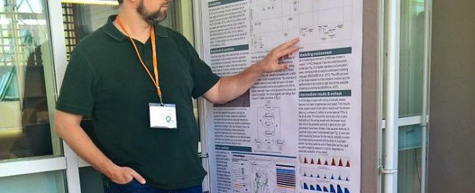
Geospatial Events Grant 2017: Stefan Mohr presenting at the GI_Forum 2017
Stefan Mohr was one of 4 UNIGIS Students receiving a grant within the first call of the UNIGIS International Association Geospatial Events Grants. The main reason for starting his MSc studies at UNIGIS Salzburg in 2015, was his interest in lifelong learning and scientific research in Geoinformatics. During his study Stefan joined also the Research Group ‘Spatial Simulation’ of Dr. Wallentin, which is giving him the possibility to discuss on a high academic level and improve his skills in Visualization of agent based models and spatial temporal relations. Based on his deep interest on scientific research, he has chosen a …
Read more…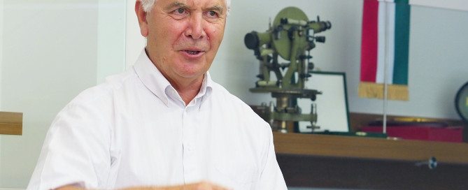
Congratulations to Prof. Dr. Béla Márkus
On behalf of all UNIGIS Association members, we warmly congratulate Prof. Dr. Béla Márkus on his 70th birthday. We also would like to thank for all his contributions to geospatial education over the past decades.
Read more…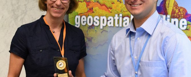
UNIGIS Academic Excellence Prize awarded to Nathan Nowak @GiForum2017
After his presentation at the AGIT / GI_Forum conference, Nathan Novak was awarded the 2nd prize of the UNIGIS International Excellent Award. He received this award for his Master Thesis on an innovative modelling approach of Sperm Whale habitats. In his research, Nathan used passive acoustic monitoring to predict the habitat distribution of Sperm Whales in the Central Gulf of Alaska. Specifically, he related the distinct occurrences of sperm whale vocalizations to environmental variables. The UNIGIS Academic Excellent Award is handed over each year to the best Master Theses within the global network of UNIGIS universities with more than 1000 …
Read more…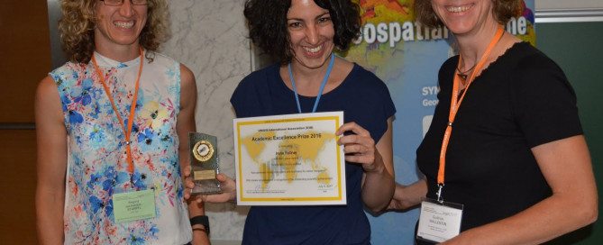
Irene Fellner receives UNIGIS Academic Excellence Prize @AGIT conference
When was the last time, when you lost your indoor orientation in an underground carpark or a large building? Whereas there are a lots of devices and apps that help us in the outdoor navigation, there is little digital support for wayfinding within buildings. Irene Fellners Master Thesis closes this gap: she developed algorithms that automatically identify indoor landmarks from building databases and calculates routes that are based on these landmarks. Irene Fellner was awarded the UNIGIS Academic Excellece Award after she presented her research in the Special Session on ‘Spatial Perspectives on Active Mobility’ at the AGIT / GI_Forum …
Read more…
Geospatial Events Grant 2017: Daniel Paco presenting at the 11as Jornadas de SIG Libre
Daniel Paco receiving a Geospatial Events Grant for attending the 11th Workshop on Free GIS (11as Jornadas de SIG Libre) Daniel Paco is a first-year student of the Master’s degree in GIS from UNIGIS Girona and he received one of the Geospatial Events Grants from UNIGIS International Association for attending the 11th Workshop on Free GIS (11as Jornadas de SIG Libre) in Girona on June 1st and 2nd. The congress, organized by SIGTE (the GIS Service of the University of Girona and promotor of the UNIGIS Girona programme), is a meeting point of the GIS community that works with free …
Read more…
Geospatial Events Grant 2017: Luke Clasper attending the VGI-Analytics 2017
For the first time UNIGIS International Association was awarding the Geospatial Events Grant for active and recently graduated UNIGIS Students around the world. Mr. Luke Clasper, who recently graduated from UNIGIS UK, was awarded a grant towards attending the VGI-Analytics 2017, Netherlands. This pre-conference workshop took place on the 9th May 2017 and was held at the AGILE (Association of Geographic Information Laboratories in Europe) 2017 conference at Wageningen University. The event was chaired and co-organised by Dr Peter Mooney (Maynooth University, Ireland) and focused on new opportunities and research challenges raised by Volunteered Geographic Information (VGI). This included cross-linking …
Read more…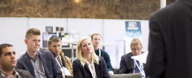
UNIGIS Geospatial Events Grants awarded
The UNIGIS International Association is pleased to announce the grantees within the first Call for “Geospatial Events Grants” (GEG). This Grant has been established to connect active UNIGIS students with the international geospatial community and enhance the learning experience beyond lessons and exercises. Four UNIGIS students have now been awarded a grant for participating in a leading Geospatial event and presenting their work to a broad audience: Daniel Paco Abenza, Master student at UNIGIS Girona, receives a grant for attending the 11th Workshop on Free GIS/11as jornadas SIG libre and his presentation on the ECOWREX project: ‘The ECOWAS Observatory for …
Read more… Previous Next