Stefan Mohr was one of 4 UNIGIS Students receiving a grant within the first call of the UNIGIS International Association Geospatial Events Grants.
The main reason for starting his MSc studies at UNIGIS Salzburg in 2015, was his interest in lifelong learning and scientific research in Geoinformatics. During his study Stefan joined also the Research Group ‘Spatial Simulation’ of Dr. Wallentin, which is giving him the possibility to discuss on a high academic level and improve his skills in Visualization of agent based models and spatial temporal relations.
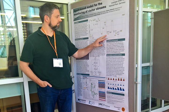
Based on his deep interest on scientific research, he has chosen a very practical-related research topic for his master thesis “Agent based modelling of socio-economic visitor monitoring. A case study of Harz National Park, Germany”, which he presented during the GI_Forum 2017 in Salzburg in a speed talk within the “Spatial Simulation Session” and also in the Poster session.
Stefan Mohr, UNIGIS Salzburg: “In this contribution, we propose an agent-based model (ABM) to simulate the visitor streams in a study area around Mt. Brocken, the area with the largest pressure of recreational use within the Harz National Park. Starting and destination points and the path network have individual parameters, including attractiveness for hikers, which also have individual parameterizations. These have an influence on selecting starting and destination points as well as the route. The calibration of the model is done by count data not used in the basic model. As a modelling environment, GAMA was chosen in version 1.7 RC2 because it has very extensive possibilities of spatial operators and simulation tasks, combined with an easy-to-understand modelling language.
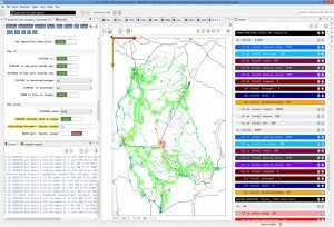 In a first step a model with all known features has been implemented and tested. First results show a good match of simulation results with the known data, e.g. numbers of visitors at some special POIs in the study area. This allows the conclusion that a parametrization of the whole model with the known input data should be possible and that in general the right parameters have been chosen. Also several methods of graphical output were implemented and add good visualizing features for the results.
I really enjoyed presenting my work to such a broad audience at the GI_Forum and it was a pleasure for me to participate in this conference! Thanks to UNIGIS International Association for providing this support.”