Call extended: UNIGIS Geospatial Events Grants – GEG
Applications accepted until April 14, 2017!!! The UNIGIS International Association is announcing the first call of the “Geospatial events grant” (GEG), funded by UNIGIS International Association and industry partners. The objective of GEG is to connect active UNIGIS students with the international geospatial community and to create added value within the UNIGIS network. Participating in a leading Geospatial event will enhance the learning experience beyond lessons and exercises and is of course an excellent opportunity to establish new contacts with GIS experts from all over the world. The call considers the following list of events eligible for grant sponsorship: Geospatial …
Read more…
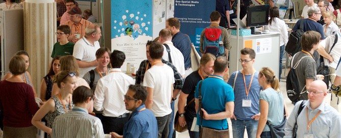
The real Living Map
As you might know there are three different kinds of networks: professional networks, personal networks and Triangular Irregular Networks. This weekend a new group of UNIGIS professional students were heavily engaged in building all kinds of networks in order to set a good starting point for a year of collaborative learning. Read the complete story…
Read more…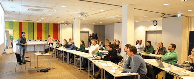
UNIGIS MSc 2016 workshop – Let´s talk about place …
… and a wide variety of issues and topics regarding distance education with a focus on the conception of the Master Thesis. That´s how you could summarise the 2nd UNIGIS MSc 2016 workshop held in Salzburg from 1 to 2 December 2016. The mix of representatives from industry and research creates ideal opportunities for a professional exchange of ideas on a scientific basis.
Read more…
Winners of the UNIGIS Academic Excellence Prize 2016
The UNIGIS International Association (UIA) announces the winners of its Academic Excellence Prize 2016. The Prize, initiated in 2008, is presented to the students submitting the best (English language) MSc thesis during the academic year and are nominated by their UNIGIS sites. This year the competition was extremely tight with seven excellent high quality MSc theses being shortlisted by the Review Panel. In the end the panel decided to make three awards. The winner of the Academic Excellence Prize for 2016 is Tim Hernon (UNIGIS UK). His thesis showed a novel approach to extract urban land use data from Volunteered Geographic Information (in …
Read more…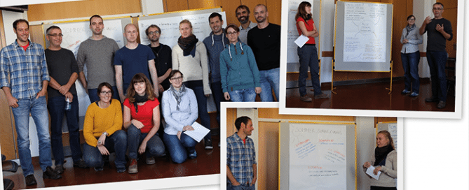
Future GIS Professionals Meeting in Salzburg
Future GIS Professionals Meeting in Salzburg Professor Strobl and the UNIGIS Professional team had the pleasure to welcome future GIS professionals in Salzburg last weekend. The highly motivated group gathered primarily to get to know each other and the UNIGIS team, but also to get in touch with the study materials and to learn about the various opportunities for specialisation in their UNIGIS professional study program. Once again it became obvious that GIS skills are required in a vast number of disciplines. The diversity of domains that were represented in the introductory workshop was large: from GIS professionals in a …
Read more…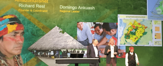
Top award for UNIGIS América Latina Director Richard Resl
Top award for UNIGIS América Latina Director Richard Resl Domingo’s present to Jack Dangermond: ‘maps serving as our spears’ During the plenary session of this year’s Esri User Conference (see link at bottom for bilingual slides), Richard Resl and Domingo Ankuash received the ‘Making a Difference’ award from Esri’s Jack Dangermond. This distinction highlights their work towards preserving Amazonian Indians’ land rights and livelihoods. Through the AmazonGISnet initiative the territories of indigenous groups are documented to preserve this native and pristine environment for their next generations. After being applauded by the 15000 strong audience for their impressive talk, Domingo presented a …
Read more…
50th workshop at UNIGIS Kraków, Poland
50th workshop at UNIGIS Kraków, Poland In the middle of June students of intake 2015 together with the organizers celebrated the 50th workshop in the history of Postgraduate Studies in Geographic Information Systems UNIGIS at Jagiellonian University in Kraków. After regular classes on GPS data collection in laboratories and in the field, students and teachers gathered in the social room of the Institute of Geography and Spatial Management JU. A speech of the programme director prof. Jacek Kozak opened the meeting, then students and teachers tasted cake and strawberries, that accompanied informal consultations. With this significant anniversary we started next …
Read more…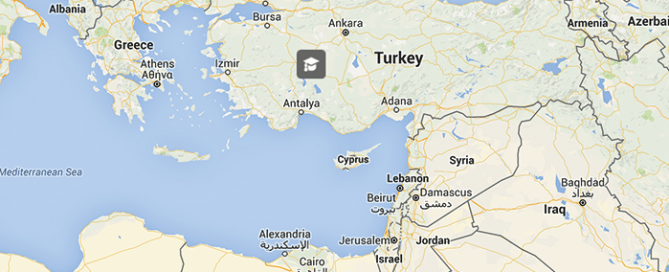
Welcome UNIGIS Turkey!
Welcome UNIGIS Turkey! Turkish language ‘lifelong learning’ students are now supported through a local UNIGIS Turkey contact point that is coordinated by Dr. Deniz Gerçek. Dr Gerçek received her PhD from the Middle East Technical University (METU) in Ankara and conducted part of her PhD studies at the University of Salzburg. Since 2010 she is affiliated with Kocaeli University in İzmit. Her research focus is on Remote Sensing and Object-Based Image Analysis connecting with other fields of GIScience including Spatial Statistics, and Application Development. The first cohort of Turkish students will be welcomed for the next student intake in autumn. …
Read more…
UNIGIS accredited by AQ Austria
Through systematic evaluation, feedback and international cooperation, UNIGIS Salzburg has always strived for top national and international quality standards in terms of content, structure and organisation of the two distance learning study programmes UNIGIS professional and UNIGIS MSc. National regulations in Austria, however, do not provide a legal framework for external evaluation of study programmes at federal universities by the official national accreditation agency AQ Austria. Therefore guidelines for a voluntary accreditation first had to be established. Today we can proudly state that UNIGIS is the first continuing education programme (‘Universitätslehrgang’) at a national university in Austria reviewed and successfully accredited …
Read more…
UNIGIS professional Workshop: Replacing Question Marks
Who are those people running UNIGIS? Who will be my colleagues? What are their reasons to acquire in depth GI-knowledge and skills? How will the study-year to come be organized? What can I do to get the most out of it? Was it a wise decision to invest a considerable amount of time and money into this endeavor? Questions like these our 16 new UNIGIS professional students might have had in mind, when traveling to the introductory UNIGIS professional workshop taking place in Salzburg last weekend. Although predominantly very positive answers from our graduates to the last question are promising, …
Read more… Previous Next