 Starting from September, we are looking forward to an exciting roster of outstanding speakers on a range of topics covering themes of current interest for UNIGIS alumni, students, and everyone else. The open u_Lecture webinar series offers a LifeLongLearning opportunity to graduates and everyone keen to follow developments across the exciting field of Geoinformatics. See below for details on upcoming talks, and preview further speakers we keenly anticipate this term:
>> Make sure you mark your calendars not to miss these unique opportunities to learn from and interact with these outstanding individuals!
>> You can watch the recording of past u_Lecture webinars here > UIA webinar channel
March 07, 5:00 pm CET > Register here for recording
> Dogan Altundag (Founder & CEO Geosignum): The role of LiDAR technology in asset mapping in urban areas
In this U_Lecture Dogan Altundag will focus on LiDAR technology in asset mapping. He is also going to share the story of GeoSignum and how GeoSignum’s technologies positioned to solve the LiDAR data processing problems.
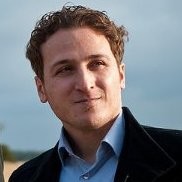 Dogan Altundag is the founder and CEO of GeoSignum, a high-tech startup develops pioneering software technologies in the field of fully automated LiDAR data processing. He holds an MSc in Geomatics from Delft University of Technology. He has been in the LiDAR field for a decade and he is known as one of the innovators in the field.
January 30, 5:00 pm CET > Register for Recording
> Paula Dijkstra (Regional Manager Europe and Central Asia, Kadaster International): Community-involved Land registration in areas prone to natural hazards and the role of GIS
In this U_Lecture Paula Dijkstra will discuss the importance of community-involved Land registration in areas prone to natural hazards and the role that GIS technologies and methods can play.
After the earthquakes in Nepal in 2015, a Post Disaster Needs Assessment indicated that land and the access to land are major concerns. HURADEC (Human Rights Awareness and Development Centre), UN-Habitat GLTN, UN-Habitat Nepal and Kadaster performed a Fit-For-Purpose Land Administration project in four villages in Dolakha district. We used participatory enumeration to identify the level of tenure security, the scale of vulnerability and the grant status. The affected houses were mapped using GPS, and high-resolution satellite imagery was used to identify the farmland. Local teams and the community collected the data in the field. This data was entered and processed using STDM and is now used to support the process to access grants, improve the land policy at national level and help the community to rebuild.
“We have met several people who didn’t have any hope of rebuilding their homes again after the earthquakes,” said Bishnu Khadka, HURADEC project coordinator. “But now they see the power of land information: they begin to have glimpses of happiness about finally getting access to the reconstruction grants. The project built confidence in them and that is a beautiful thing.” source: Abroad newsletter, October 2015.
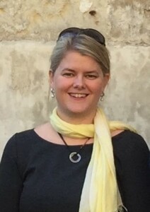 Bio: Paula Dijkstra works as Regional Manager Europe and Central Asia for the international department of the Netherlands’ Cadastre, Land Registry and Mapping Agency (Kadaster). She has a Master degree in Social Geography and a degree in cadastral data acquisition and 3D modelling. She is responsible for the international projects in the Central and Eastern European region and the joint projects of Kadaster and the Global Land Tool Network under UN Habitat.
In 2020 the Working Week of the International Federation of Surveyors (FIG) will take place in Amsterdam, the Netherlands. Paula is appointed as the co-conference director for this event.
September 26, 5:0pm CET > Register for recording
> Dr. David Comas (Chief executive Officer, NEXUS GEOGRAPHICS ): What does a GIS professional need to work in the geolocation sector?
This u_Lecture will be held in Spanish language!
Currently, companies in the GIS sector still need professionals and young talents to create new applications and to take advantage of the interesting innovations in geolocation technology that we are experiencing.
What key skills should these professionals have? Dr. David Comas will try to answer this question in his webinar, based on his experience accumulated over two decades that have been very intense in every way. In the beginning of NEXUS, most of the team were “GIS analysts” and a minority were “GIS developers”. Currently, this proportion has been reversed.
The geolocation market is more open than ever, with exciting opportunities at a professional level. It is a very important issue for the specialists who are being trained and also for the companies. In the webinar, Dr. Comas will propose to open a direct debate, based on concrete facts, practical and useful.
 Bio: Dr. David Comas, Consejero Delegado, NEXUS GEOGRAPHICS. David was obtaining his degree in Geography at the University of Girona. With extensive experience applying maps to improve the functioning of companies and administrations, he has lead more than 300 Geolocation and Geographic Information Systems projects.
More information on upcoming talks will be published soon!