Winners of the UNIGIS Academic Excellence Prize 2023
UNIGIS Honors Top Master’s Students with 2023 Academic Excellence Awards The UNIGIS International Association (UIA) is proud to announce the winners of the 2023 Academic Excellence Prize. Since 2008, this prestigious award has recognized outstanding Master’s theses in the field of Geographic Information Systems (GIS) from students at UNIGIS partner universities worldwide. Rigorous Competition Yields Exceptional Winners This year, the UNIGIS International Association Review Board had the challenging task of evaluating seven exceptional Master’s theses. After careful consideration, they selected three winners: First Place: Christopher S. Hayner, University of Southern California (USA). Thesis title: “Exploring the Pernicious Effects of Redlining …
Read more…Winners of the UNIGIS Academic Excellence Prize 2022
Every year, since 2008, the UNIGIS International Association (UIA) awards the Academic Excellence Prize to students having submitted the best MSc theses (or paper) during the previous academic year, accepted for graduation at one of the UNIGIS partner universities worldwide. In this year’s competition six excellent, high-quality MSc theses were considered by the UNIGIS International Association Review Board. The panel decided to make three awards, including one winner, one runner-up and one third place of the Academic Excellence Prize for 2022: The Winner of the Academic Excellence Prize 2022 is Artur Jorge Abreu Varanda, from NOVA Information School – Universidade …
Read more…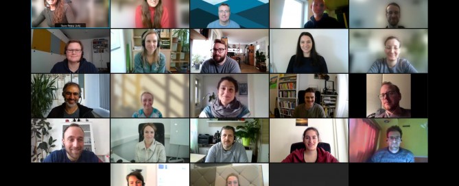
UNIGIS Professionals Introductory Workshop goes Online… again
Two years ago, as a result of the pandemic, we changed the format of the UNIGIS Professional introductory workshop from on-site to online. That was a big change for us as well; after all, there’s no substitute for that cozy after-work beer in a rustic guest garden on Friday evenings. But over time, we got used to it and eventually realized that not everything about an online workshop is bad. Especially the fact that it saves a lot of (travel) time and the associated costs while on the same time preventing the ecological footprint from growing was reason enough to …
Read more…Winners of the UNIGIS Academic Excellence Prize 2020
The annual UNIGIS International Academic Excellence Prize, initiated in 2008, is awarded to UNIGIS students having submitted the best MSc theses (or paper) during the previous academic year, accepted for graduation at one of the UNIGIS partner universities worldwide. This year the competition was very tight with excellent high quality MSc theses being considered by the UNIGIS International Association Review Board. In the end, the panel and board decided to make five awards: The winner of the Academic Excellence Prize 2020 is Lindsay Hennes from University of Southern California. Her outstanding Master Thesis “Increase in Surface Temperature and Deep Layer Nitrate …
Read more…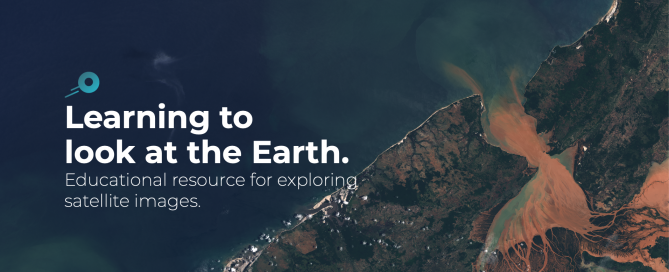
Edusat – an educational platform for exploring satellite images
Edusat is a website aiming at teachers, researchers and the general public. It has been developed by the Geographical Information Systems and Remote Sensing Service (SIGTE) of the University of Girona (Spain) to facilitate the discovery of satellite images and explore the Earth’s surface. Satellite images make it possible to analyse phenomena such as forest fires, floods or the melting of glaciers, as well as other socio-environmental problems. Today, observing the Earth from space is easier than ever. Geographic Information Technologies (also called geo-ICT) allow you to know from anywhere on the planet ‘where’ and ‘why’ some phenomena occur. Remote …
Read more…
Virtual kick-off workshop with new UNIGIS Salzburg professional students
As the COVID‐19 pandemic spurs all of us to keep spatial (- not social) distance, we must adapt to this new circumstances by going digital wherever possible. For a distance-learning program such as UNIGIS not a problem at all, considering that our modules were designed to be studied individually from home. Still, we traditionally held our kick-off workshops on-site in Salzburg to meet our students at least once in person. Nevertheless, yet for the second time and for the sake of safety, we decided to relocate this workshop into the online world. To overcome one of the major downsides in …
Read more…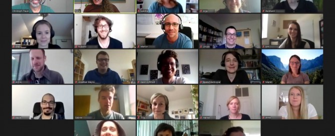
First virtual UNIGIS professional workshop
The rapid change to distance education during the COVID 19 pandemic impressively showed the enormous potential of digital media to foster teaching and learning. We expect the collective experience that “distance education works” will change decision maker’s minds and lead to new formats in university education. While several university teachers faced substantial problems when trying to adapt their lectures to a new format, the change to online teaching in residential programs was not a big deal for faculty members who are involved in UNIGIS. More than 25 years of experience in distance education simply matter. While many aspects in learning …
Read more…Congrats to UIA Academic Excellence Prize winners 2019
Every year, the UNIGIS International Association (UIA) awards the Academic Excellence Prize to students having submitted the best MSc theses during the previous academic year, accepted for graduation at one of the UNIGIS partner universities worldwide. In this year’s competition five excellent, high-quality MSc theses were considered by the Review Panel. The panel decided to make three awards, including one winner and two joint runners-up of the Academic Excellence Prize for 2019: Cass E. Kalinski, UNIGIS USA, was awarded the first place for his Master thesis “Building Better Species Distribution Models with Machine Learning: Assessing the Role of Covariate Scale …
Read more…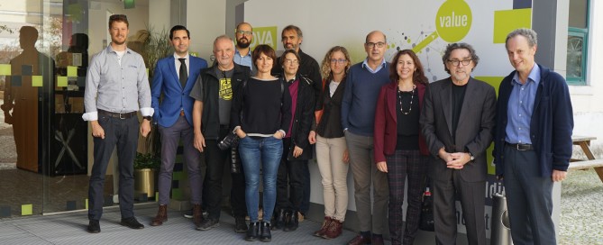
UNIGIS – a lively network
UNIGIS, as a worldwide network of universities, is cooperating since almost 30 years in the design and delivery of distance learning programs in Geographical Information Systems and Science. Once a year all UNIGIS Institutions meet for their General Assembly, which is organized annually by a different member institution. This year the meeting was held from November 8-9, 2019 and hosted by NOVA-IMS in Lisbon. The main purpose of this annual meeting is to coordinate, further develop and sustain the quality of the study programs offered through the different UNIGIS Institutions around the globe. They are cooperating and working together to …
Read more…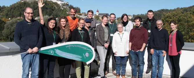
Kick-off for our new GIS-professionals
Weatherise, Salzburg was presenting itself from its finest side when we welcomed our new highly enthusiastic UNIGIS Salzburg Professional students to our introductory workshop. Yet again, the interdisciplinary nature of Geoinformatics is shown in the quite diversified fields our new students come from. It is reaching from piloting aircrafts, logistics, development assistance, robotic programming right up to archelogy. In one year, our students will learn about spatial concepts and methods, which will consequently privilege them to get most out of spatial data. Considering the heterogeneity of the student’s professional background, the learning experience will be even more interesting and insightful …
Read more… Next