UNIGIS at GeoSmart Asia ‘2015 – Kuala Lumpur
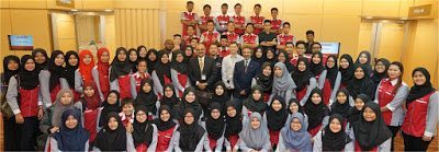
UNIGIS was invited to contribute to the GeoSmart Asia 2015 (GSA) conference held in Kuala Lumpur, Malaysia from September 29th to October 1st, 2015 and to co-organise the ‘Geospatial Youth Forum’ bringing academia, industry, organisations and students onto a common platform for promoting career-oriented one-on-one interaction. GSA is one of the largest regional conferences focussed on geospatial themes in S/E Asia and is being organised in different countries across the region. UNIGIS has been entrusted with a prominent role of conducting Geospatial Capacity Building sessions at the event since 2005 and this was the 11th such continuous session coordinated by …
Read more…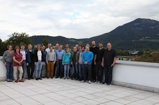
Master Thesis workshop in Salzburg
From 18th to 19th of September more than 20 students from the UNIGIS MSc 2014 course presented a current status of their Master Thesis during the workshop in Salzburg. High quality presentations from various sectors of GI and a lively discussion among students and the teaching team led to an informative and entertaining meeting. All the best for the final steps! UNIGIS MSc 2014
Read more…
New U_Lecture on Platform 3DNL September 23
This autumn series of U_Lectures are hosted by our member UNIGIS Amsterdam in cooperation with several industry partners. Don’t miss this opportunity and register now for the U_Lecture on Platform 3DNL with industry experts Rob van de Velde (Geonovum), Henk Scholten (Geodan/VU University Amsterdam) and Sanne Hettinga (VU University Amsterdam). Date: Wednesday September23 Time: 4-5 pm (CEST) U_Lecture 3DNL Due to increasing complexity of spatial processes, decisions about the public space are becoming harder. Accurate and real-time 3D information is necessary to support effective and transparent decision making. Platform 3DNL is seeking to establish a national 3D Geo-Information Infrastructure in …
Read more…
UNIGIS Sub Saharan African Student offered lucrative bursary
Ms Marthie Schoeman, UNIGIS Sub Saharan Africa student has been awarded a coveted bursary by EE Publishers South Africa to attend this year’s Geomatics Indaba in South Africa, all expenses paid. EE Publishers have a particular focus on the electrical, electronics, measurement, automation, control, computer, information, geo-informatics and communication technology sectors of Southern Africa. UNIGIS wishes Marthie a wonderful trip to Ekurhuleni and we hope she learns a lot!
Read more…
Congratulations to UNIGIS Southern Africa Student! Congratulations to Ms Gudani Mammba from UNIGIS Sub Saharan Africa! She has been awarded a bursary by GISSA, The GI Society for Southern Africa to attend the Geomatics Indaba 2015 from 11-13 August at the Emperor’s Palace, Ekhuruleni. This is a major Geomatics industry event and is jointly organised and hosted by SAGI, IMSSA, and GISSA in collaboration with EE Publihers. As a service to the GIS community GISSA decided to sponsor 5 deserving Geoinformatics University Students to attend the conference. The sponsorship will entail payment by GISSA of the conference fees and travel …
Read more…
Trimble providing software support to UNIGIS students
Trimble’s Hans-Jürgen Gebauer and Prof Josef Strobl signing agreement Today at the GI_Forum conference in Salzburg, Trimble Navigation Limited and UNIGIS International concluded an agreement offering complimentary licenses to all registered UNIGIS distance learning students worldwide. Under the terms of this agreement, students have free access to eCognition, INPHO, UAS Master, Pathfinder Office, SketchUp Pro and further software technologies for their study assignments and thesis development. Though best known for GPS technology, Trimble integrates a wide range of positioning technologies including GPS, laser, optical and inertial technologies with application software, wireless communications, and services to provide complete commercial solutions. Its integrated …
Read more…
Academic Excellence Prize awarded at GI_Forum
Heidi El Hosaini (UNIGIS Manchester) had been named the winner of the annual worldwide UNIGIS Master Thesis competition in October 2014 for her dissertation titled “Locating and positioning solar panels in a 3D city model – a case study of Newcastle”. This thesis was developed with sponsorship from the UK Ordnance Survey. The prize carried an invitation to the GI_Forum Salzburg, where she published and presented her work in a well received talk in the main conference program, and received the ‘trophy’ and an award certificate. The winner says: “My dissertation demonstrates potential applications and techniques using Ordnance Survey’s 3D …
Read more…
AGIT / GI_Forum – annual UNIGIS meeting place!
Staying up-to-date professionally requires a focus on two things: following new developments in geospatial technologies and methods, and to be well connected in a network of peers. Both objectives are well supported through our annual pair of conferences, AGIT and the English language GI_Forum. Outstanding keynotes provide inspiration and perspective. With a rich program of workshops, paper presentations and tutorials, the choices of relevant and timely continuing education offerings sometimes are hard, but rewarding. The presence of UNIGIS alumni from all over the world, and from every vintage provides an excellent opportunity to enhance one’s network, of course assisted by a diversity …
Read more…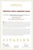
UNIGIS receiving ‘Geospatial Institution of the Year’ award
At this week’s Geospatial World Forum in Lisbon, the worldwide UNIGIS organisation as a network of academic partner institutions offering graduate qualifications in Geoinformatics was presented with the ‘Geospatial Institution of the Year’ award, recognizing our leading role in ‘Educating GIS Professionals Worldwide’. Prof Marco Painho from UNIGIS Portugal and Dr Shahnawaz from UNIGIS India joined UNIGIS Int’l chair Prof Josef Strobl accepting this award during the Geospatial World Awards Gala evening on May 27.
Read more…
UNIGIS Scholarships for Russia&CIS Students
UNIGIS Стипендии для России и СНГ!
The University of Salzburg with its Interfaculty Department of Geoinformatics – Z_GIS is offering up to 10 partial scholarships for UNIGIS distance learning MSc students for students from Russia and CIS countries. UNIGIS Salzburg is inviting applications for scholarships covering approx. 60% of the Euro 9800.- tuition fee. Following the vision of ‘Educating GIS Professionals Worldwide’, the UNIGIS MSc degree is a highly regarded and widely acknowledged postgraduate qualification offered in English language. Candidates from the Russia / CIS region are offered the opportunity of Russian language consultation, guidance and support. Applications for scholarships will be ranked based upon prior knowledge, …
Read more… Previous Next