 This autumn series of U_Lectures are hosted by our member UNIGIS Amsterdam in cooperation with several industry partners. Don’t miss this opportunity and register now for the U_Lecture on Platform 3DNL with industry experts Rob van de Velde (Geonovum), Henk Scholten (Geodan/VU University Amsterdam) and Sanne Hettinga (VU University Amsterdam).
Date: Wednesday September23
Time: 4-5 pm (CEST)
U_Lecture 3DNL
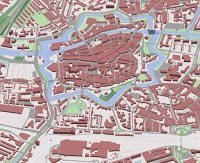
Due to increasing complexity of spatial processes, decisions about
the public space are becoming harder. Accurate and real-time 3D
information is necessary to support effective and transparent decision
making. Platform 3DNL is seeking to establish a national 3D
Geo-Information Infrastructure in the Netherlands. Two initiators, Rob
van de Velde (Geonovum, public sector) and Henk Scholten (Geodan,
private sector), and PhD student Sanne Hettinga (VU Amsterdam) will
reflect on their vision and work plan and explain why so many government
agencies, companies and universities have committed their participation
in the Platform. What are the challenges and opportunities in
successfully implementing 3DNL and how will it strengthen the
international position of the Netherlands.
Presenters
Rob van de Velde is Director of Geonovum and Board Member of the
Open Geospatial Consortium. Geonovum is responsible in The Netherlands
for making public sector geo-information widely accessible and develops
and maintains the required standards. For the development and
maintenance of a national Geo-Information Infrastructure, Geonovum
connects policy and practice.
Henk Scholten is founder and CEO of Geodan, one of the largest
European companies specialised in Geo-IT. He is also Full Professor in
Spatial Informatics at the Department of Spatial Economics, at the VU
University Amsterdam, Director of UNIGIS Amsterdam and co-founder of
UNIGIS International.
Sanne Hettinga is a PhD student at the VU Amsterdam university,
studying the role of 3D data in environmental modeling (the project 3D
for Environmental Modelling at the Maps for Society programme).