Save the date: 25th May Young Professionals Forum GWF Rotterdam
‘Making a Difference in Geospatial Industry’ Wednesday, 25 May 2016, 0900-1800 hrs UNIGIS is a partner in the Young Professionals Forum at Geospatial World Forum Conference in Rotterdam. The Young Professional Forum aims to provide a platform for students and industry to share the same stage and discuss how the next generation geospatialists can make a difference in our ever-changing industry. Students will be given opportunities to present their research work (thesis) at the Forum in front of prospective employees, followed by a special pitch session by companies and government agencies to promote internships and job opportunities for students. Do …
Read more…
UNIGIS MSc 2016 successfully launched in Salzburg
Personal interaction with fellow students and the UNIGIS teaching team was one of the main foci of the 2-day introductory workshop held in Salzburg. This was complemented with an overview of information on study administration and curriculum content, providing a detailed insight into the UNIGIS distance learning framework. The UNIGIS MSc study day’s on 18th and 19th February were attended by 36 new students from Germany, Austria and Switzerland. The very diverse educational and professional backgrounds of UNIGIS students contribute to making personal get-togethers in Salzburg not only informative, but also contribute to an enriching and exciting start-up event. The …
Read more…
UNIGIS 2016: Info-Webinar zur Studienberatung
Sie haben einen Beruf und wollen trotzdem an der Universität studieren? Sie arbeiten vielleicht sogar schon mit GIS Werkzeugen und wollen die ‘Konzepte dahinter’ besser verstehen? Sie haben berufliche Pläne oder sind einfach nur neugierig auf Neues? Die Anmeldefrist für den UNIGIS MSc Jahrgang 2016 endet in Kürze! Zur Orientierung, für Studienberatung und zu Ihren Fragen zum UNIGIS Fernstudium an der Universität Salzburg steht das Lehrgangsteam im Rahmen eines Webinars zur Verfügung! Dienstag, 2. Februar 2016, 17:30 – 19:00 MEZ Webinar-Registrierung: https://attendee.gotowebinar.com/register/8349071548933460737
Read more…Running ArcGIS 10 on Windows 10 There are a lot of complaints on web fora from people trying to run ArcGIS 10.x on a Windows 10 OS. One complaint that frequently can be read is the fact that the menu bar and/or toolbar and/or ArcToolbox window items are displayed way too small on high-resolution displays (e.g. 3200×1800 HD). I experienced the same problems when I installed ArcGIS 10.1 on my new Windows 10 laptop: the toolbar items and my ArcToolbox window items were not readable. I’ve been experimenting with different solutions and found this combination to be working for me. …
Read more…
New Board UNIGIS International Association installed
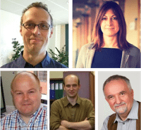
UIA Board members 2016: Jasper Dekkers, Gemma Boix, Graham Smith, Jacek Kozak, Josef Strobl The UNIGIS International Association has a new composition of its board. Dr. Jasper Dekkers, already a board member in his role as treasurer, is the new chair of the UNIGIS International Association (UIA). Jasper is affiliated with UIA through UNIGIS Amsterdam, offered by VU University Amsterdam in The Netherlands. Former Chair Professor Josef Strobl (UNIGIS Salzburg) is now general board member, responsible for partnerships within UIA. Professor Jacek Kozak (UNIGIS Krakow) is UIA’s new treasurer. Gemma Boix (UNIGIS Girona) is responsible for all UIA marketing matters and …
Read more…
Sign up for tomorrow’s free U_Lecture about Minecraft in Schools (5-6PM CET)
Is Minecraft a useful teaching tool? Researchers at SPINlab (Vrije Universiteit Amsterdam) are trying to find the answer to this question. Their focus group are teachers who use Minecraft in the classroom in three Dutch schools in Lelystad, Zaandam and Amsterdam. These teachers can provide valuable feedback about whether Minecraft is an effective teaching tool. Parallel to this, the project GeoCraft NL is developed: a Minecraft world with the whole of the Netherlands on a scale 1:1. The project, initiated by the Dutch Geo Science Center GeoFort, delivers a map with all the trees, roads, rivers and buildings in the …
Read more…
UNIGIS Salzburg @ Capturing Reality Forum
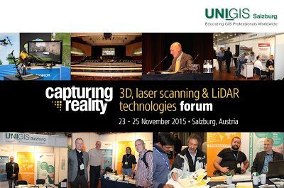
The Capturing Reality Forum took place at the Salzburg Congress in Salzburg, Austria, from 23-25 November 2015. The Forum provided an inspiring platform for professionals to meet, learn and share ideas with industry’s best with a focus on technologies of laser scanning, LiDAR and 3D data capture and modeling. A tendency can be observed, in which photogrammetry in near real-time processing plays a significant role in obstacle detection and semantic recognition from images to be implemented in road traffic solutions. The major problem is, to filter out the relevant data from massive image data, says keynote speaker, Luc Van Gool (ETH Zürich). In this context LIDAR and photogrammetry have been …
Read more…
UNIGIS Academic Excellence Prize 2015
Winners of the UNIGIS Academic Excellence Prize 2015 UNIGIS UK celebrates its 25th anniversary of the first intake in Manchester on October 22-24. During this meeting the UNIGIS International Association (UIA) announced the winners of its 2015 Academic Excellence Prize. This award, initiated in 2008, is presented to the student, or students, nominated by their UNIGIS sites for submitting the best MSc thesis (or paper) during the academic year. This year the competition was very tight with nine excellent high quality MSc theses being considered by the review panel. In the end the panel decided to grant three award winning theses. …
Read more…
West is up? Nevermind!
Meeting for an introductory workshop in Salzburg last weekend, our new UNIGIS professional students were already perfectly working together making THEIR map. It consists of 23 (quite active and human 😉 ) symbols, representing 23 home locations between Kiel and Klagenfurt and between Bern and Vienna. “Collective mapping” While one might argue this map fails to meet several cartographic conventions including correct orientation, we would reply that map orientation does not matter at all, as long as they got good orientation for the intensive year of UNIGIS-studies to come. All the best to you for this challenging endeavour!
Read more…
Upcoming U_Lecture on Smart Mobility & Geodata October 21, 5-6 PM
Wed October 21, 5:00 PM – 6:00 PM (CET): “Smart Mobility and Geodata” Dr. Marianne Linde, member Board of Directors Geodan Gerrit Schipper, specialist in information science and automotive industry In this edition of the UNIGIS Lectures we will talk about the role of geodata in the possibilities that Smart Mobility has to offer nowadays and in future. The automotive industry seems ready for a mobility revolution, but is our broader (geo data) infrastructure and what role is there for our geo-ict experts? Join our Smart Mobility & Information experts Marianne Linde and Gerrit Schipper on October 21 in our …
Read more… Previous Next