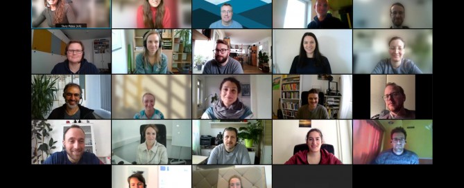
UNIGIS Professionals Introductory Workshop goes Online… again
Two years ago, as a result of the pandemic, we changed the format of the UNIGIS Professional introductory workshop from on-site to online. That was a big change for us as well; after all, there’s no substitute for that cozy after-work beer in a rustic guest garden on Friday evenings. But over time, we got used to it and eventually realized that not everything about an online workshop is bad. Especially the fact that it saves a lot of (travel) time and the associated costs while on the same time preventing the ecological footprint from growing was reason enough to …
Read more…
GI_Week 2021 in Salzburg
Last week, the Department of Geoinformatics – Z_GIS at the University of Salzburg was hosting a week full of knowledge exchange, networking and inspiration. The GI_Week in Salzburg has been a unique opportunity to meet experts in the field, to discuss the latest research in and outside many different sessions, or start a new project over a cup of coffee or during a walk on the premises of the University of Salzburg’s Faculty of Natural Sciences. While the organizers decided to hold the GI_Forum2021 once again as a virtual conference, the German-language AGIT was realized as a hybrid-event. Additionally, the …
Read more…
Winners of the UNIGIS Academic Excellence Prize 2020
The annual UNIGIS International Academic Excellence Prize, initiated in 2008, is awarded to UNIGIS students having submitted the best MSc theses (or paper) during the previous academic year, accepted for graduation at one of the UNIGIS partner universities worldwide. This year the competition was very tight with excellent high quality MSc theses being considered by the UNIGIS International Association Review Board. In the end, the panel and board decided to make five awards: The winner of the Academic Excellence Prize 2020 is Lindsay Hennes from University of Southern California. Her outstanding Master Thesis “Increase in Surface Temperature and Deep Layer Nitrate …
Read more…
UNIGIS International Association @EsriUC 2021
Like in the past year, the Esri User Conference 2021 (Esri UC) is again a fully virtual experience, enabling users and students from allover the world an interactive online experience with Esri and the GIS community. Also UNIGIS International Association will be part of the Esri UC as exhibitor. So take the chance and visit UNIGIS International Association and our UNIGIS Institutions at our virtual booth during one of the leading GIS events of the year. We are looking forward to meet current UNIGIS students, alumni and all of you interested in Geoinformatics and distance learning. Our team will be …
Read more…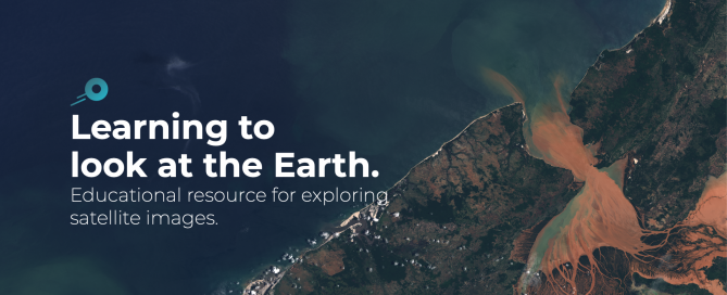
Edusat – an educational platform for exploring satellite images
Edusat is a website aiming at teachers, researchers and the general public. It has been developed by the Geographical Information Systems and Remote Sensing Service (SIGTE) of the University of Girona (Spain) to facilitate the discovery of satellite images and explore the Earth’s surface. Satellite images make it possible to analyse phenomena such as forest fires, floods or the melting of glaciers, as well as other socio-environmental problems. Today, observing the Earth from space is easier than ever. Geographic Information Technologies (also called geo-ICT) allow you to know from anywhere on the planet ‘where’ and ‘why’ some phenomena occur. Remote …
Read more…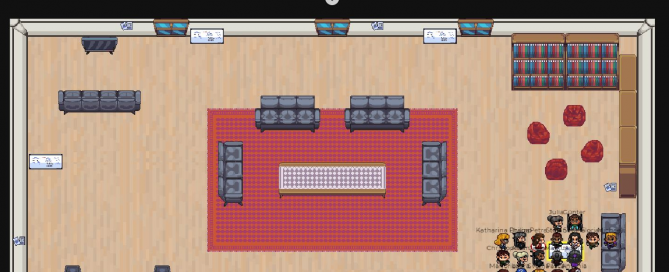
Virtual kick-off workshop with new UNIGIS Salzburg professional students
As the COVID‐19 pandemic spurs all of us to keep spatial (- not social) distance, we must adapt to this new circumstances by going digital wherever possible. For a distance-learning program such as UNIGIS not a problem at all, considering that our modules were designed to be studied individually from home. Still, we traditionally held our kick-off workshops on-site in Salzburg to meet our students at least once in person. Nevertheless, yet for the second time and for the sake of safety, we decided to relocate this workshop into the online world. To overcome one of the major downsides in …
Read more…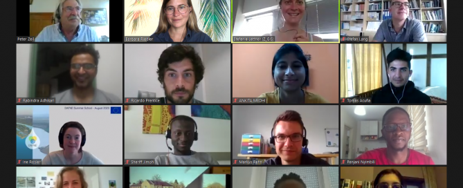
GEOBIA Virtual Summer School
This year´s UNIGIS Summer School was planned to take place in early July, embedded in the GEOBIA 2020 event during the Salzburg GI Week, jointly organized by UNIGIS Salzburg and within the public outreach and education activities of the CopHub.AC project. However, due to the worldwide exceptional situation regarding the COVID-19 virus and severe travel restrictions, our team decided to adapt the Summer School into a remote event. Based on many years of experience in distance learning and with great support of our UNIGIS lecturer Barbara Riedler, who is also leading the CopHub.AC project, the outline of the summer …
Read more…UNIGIS at the first virtual Esri UC
The 2020 Esri User Conference (Esri UC) is a completely virtual event designed to give users and students an interactive, online experience with Esri and the GIS community. As every year, UNIGIS International Association will be part of the Esri UC Expo. So take the chance and visit UNIGIS International Association and our UNIGIS Institutions at our virtual booth during one of the leading GIS events this year. We are looking forward to meet current UNIGIS students, alumni and all of you interested in Geoinformatics and distance learning. Our team will be available during Expo hours, beside …
Read more…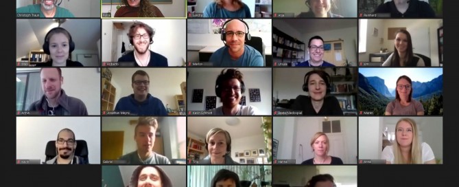
First virtual UNIGIS professional workshop
The rapid change to distance education during the COVID 19 pandemic impressively showed the enormous potential of digital media to foster teaching and learning. We expect the collective experience that “distance education works” will change decision maker’s minds and lead to new formats in university education. While several university teachers faced substantial problems when trying to adapt their lectures to a new format, the change to online teaching in residential programs was not a big deal for faculty members who are involved in UNIGIS. More than 25 years of experience in distance education simply matter. While many aspects in learning …
Read more…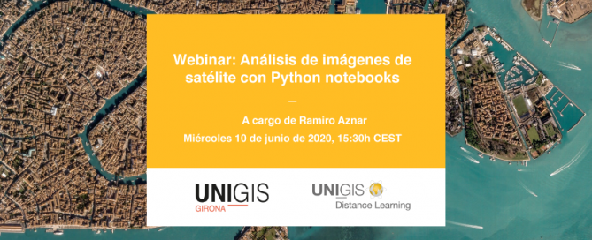
u_Lecture webinar summer semester 2020
Starting from March, we are looking forward to an exciting roster of outstanding speakers on a range of topics covering themes of current interest for UNIGIS alumni, students, and everyone else. The open u_Lecture webinar series offers a LifeLongLearning opportunity to graduates and everyone keen to follow developments across the exciting field of Geoinformatics. See below for details on upcoming talks, and preview further speakers we keenly anticipate this term: >> Make sure you mark your calendars not to miss these unique opportunities to learn from and interact with these outstanding individuals! >> You can watch the recording of past …
Read more… Previous Next