
UNIGIS Salzburg receiving ESRI Special Achievement Award
UNIGIS professional program director Christoph Traun presenting the award insignia The University of Salzburg Department of Geoinformatics – Z_GIS today received special recognition for its successful UNIGIS education program. At the International ESRI User Conference the ‘Special Achievement in GIS’ Award was presented by Jack Dangermond to our education team, acknowledging its contribution to capacity building worldwide, innovation in geospatial education and services leading to professional qualifications. The ‘Special Achievement in GIS’ (SAG) Award every year goes to a distinguished few institutions, and we at Z_GIS are proud to be highlighted this year among academic Geoinformatics researchers and educators worldwide. …
Read more…
UNIGIS thesis winning award at ETH Zurich
Big time congratulations to Simon Häsler: he not only recently completed his UNIGIS MSc at the University of Salzburg, but also managed to collect the prestigious distinction of ‘Student of the Year’ at ETH Zürich, where his thesis was supervised by Prof Martin Raubal. From the News at ETH Zürich: “In its role as Esri Development Center (EDC) the Institute of Cartography and Geoinformation once per year awards the EDC price for the best student thesis for which Esri technologies were used. This year’s price is awarded to Simon Haesler for his thesis about „Erstellung und Evaluation einer service-orientierten Systemarchitektur …
Read more…
Learning QGIS
You always wanted to extend your GIS software skills towards FOSS products like QGIS? There is no excuse not to start on your own, with excellent learning materials freely available online: One recent highlight are ‘MOOC’-style online courses: http://foss4geo.org/ Start with https://canvas.instructure.com/enroll/LA4DR9 There is an extensive training manual: http://manual.linfiniti.com/en/index.html With video tutorial support: http://qgis-tutorials.mangomap.com/post/79334660226/qgis-video-tutorials-module-1-the-interface And of course documentation: http://www.qgis.org/en/docs/index.html Plus the invaluable book by Anita Graser: http://www.packtpub.com/learning-qgis-2-0-to-create-maps-and-perform-geoprocessing-tasks/book For sure you will find summer schools, conferences, trainings etc as well! So … just ‘do it’, enjoy the lifelong learning experience, and lots of success with your GIS projects!
Read more…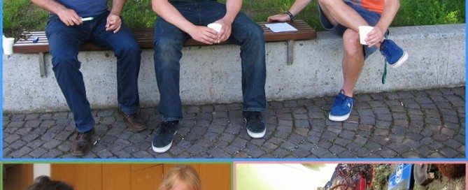
UNIGIS professionals @ work
This weekend a group of 16 professionals from various disciplines got together in Salzburg to participate in an introductory workshop of the UNIGIS professional certificate distance learning program in Geoinformatics. …Wait a minute, did you say WORKshop? Look at the pictures! Hm, yes, there was work done, but the pictures illustrate the probably most important part of this event: Getting to know each other to go together into a year of intensive learning, requiring discussion and mutual support!
Read more…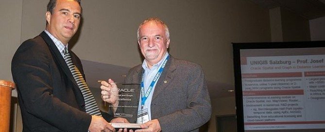
Oracle Excellence in Education Award for UNIGIS
During the Oracle Spatial Summit on May 22 2014 in Washington, DC, UNIGIS Salzburg was distinguished as recipient of the Oracle Spatial and Graph Excellence Award in the ‘Education and Research’ category. Xavier Lopez, Senior Director for Oracle Server Technologies presented the award to Prof. Josef Strobl from the Department of Geoinformatics – Z_GIS, University of Salzburg. In his remarks, Xavier Lopez recognized the worldwide outreach facilitated by UNIGIS distance learning programmes, putting graduate geospatial education within reach of everyone interested. Qualified alumni are the critically important resource to develop geospatial applications and to leverage current and future technologies. The …
Read more…
Registration countdown for the 5th Open Source Opportunities in GIS Summer School
The 5th Open Source Opportunities in GIS Summer School focused on Open Web Services and Web Map Applications will take place from 7th to 11th of July 2014 in Girona. It’s organized by SIGTE of the University of Girona with the contribution of Prodevelop (partner de OpenGeo) and the Nottingham Geoespatial Institute of the University of Nottingham. The Open Source Opportunities in GIS Summer School is an initiative aimed to meet the GIS professional demands related to free and open solutions, and we are working on this vision from the start. The Summer School 2014 will be focused on the …
Read more…
Winners: UNIGIS Master Thesis Award 2014
We congratulate all finalists – Marco Saner, Keith Peterson and Bernd Härtwig – to being selected as the top MSc theses in 2013! In a public vote following brief presentations in an online webinar format Keith Peterson was identified as the overall winner. In his master thesis he presents an approach for Monitoring Mangrove Reforestation with TerraSAR-X in Senegal. Learn more about this exciting research on our UNIGIS Alumni Website! Congratulations to Keith from the entire UNIGIS team. We are looking forward to welcoming Keith at the AGIT / GI_Forum Symposium (July 2-4 2014) in Salzburg.
Read more…
u_Lecture: Euro Beinat on Collective Sensing
On May 2nd, Prof Euro Beinat will be speaking on ‘Data Science and Predictive Analytics’, exploring the emerging world of collective sensing, how new data streams such as social media or digital transactions provide new sources to understand our collective behavior and make complex systems such as cities more transparent. Prof Beinat is professor at Z_GIS, and leads research on Data Analytics and Collective Sensing within the PhD School for GIScience at the University of Salzburg. He coined the term “Collective Sensing” for describing the growing science and practice of measuring and predicting the dynamics of large complex systems, such …
Read more…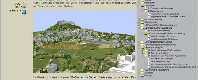
A step towards better maps
Good maps require more than just displaying your data, add a legend, a scale bar and the “obligatory” north arrow. If you want to “hook” your audience and tell your “location based story” in an intuitive way, there is a lot to consider: The nature of the phenomenon you are portraying, the application context, the target audience or the chosen technology are only a few of the multitude of variables to take care of. The latest release of the UNIGIS Module on Cartography and Visualization provides essential information on how to transform your data into appealing, yet effective maps “that …
Read more…
Capacity Building Initiatives of UNIGIS Latin America
During the last weeks, UNIGIS in Latin America carried out a series of capacity building initiatives in Ecuador and Colombia. By beginning of March, a new residential program for GIS-based Management of Indigenous Territories in the Amazon Lowlands was initiated under the lead of Richard Resl, UNIGIS program director at USFQ. He and his highly motivated staff welcomed a first group of members of the indigenous communities of Woarani, Siona, A’ I (Cofan), Siekopaai, Shuar, Kichwa, and Achuars to become part of this initative over the next five months. For further information please see: http://amazongisnet.blogspot.com In cooperation with the UNIGIS …
Read more… Previous Next