
 Starting from October, we are looking forward to an exciting roster of outstanding speakers on a range of topics covering themes of current interest for UNIGIS alumni, students, and everyone else. The open u_Lecture webinar series offers a LifeLongLearning opportunity to graduates and everyone keen to follow developments across the exciting field of Geoinformatics. See below for details on upcoming talks, and preview further speakers we keenly anticipate this term:
>> Make sure you mark your calendars not to miss these unique opportunities to learn from and interact with these outstanding individuals!
Jan 31, 5pm CET >Register for recording
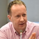
>Richard Simpson (Director, Meta Moto Pty Ltd): Digital Earth as a critical infrastructure and global collaboratory
Digital Earth is a global initiative to collate rich information and construct a comprehensive virtual representation of the planet that deepens understanding of the complex interactions of the physical world and the bearing these may have on our daily lives. The initial scientific work, with a focus on the physical aspects of our habitat, has revealed clearly the impact of large human populations and their activity. There is a need for substantial change in human activity.
However, although digital technologies are now highly advanced they are not yet well integrated into cultures globally. The warnings about over consumption, climate change and ecological degradation have been largely ignored or contested by people who have little knowledge of, or trust in, research via satellites and sensors, data management, modelling techniques and the reports of an elite group of scientists. Historically, scientific knowledge has not been shared with most people in ways that inform and include them enough to enable deep learning, cultural change and access to emerging opportunities.
 Bio: Richard Simpson is a director of Meta Moto and was previously CEO of Spatial Industries Business Association Queensland. He was a co-founder of New Zealand’s first 3D computer graphics company, led development of spatial platforms now deployed across 80 nations, and is a former Auckland City Councillor and Chair of Transport. He has had a professional interest in the development of technology for the spatial industry for over 25 years.
Past speakers in this semester:
Oct 11, 5pm CET >Register for recording
>Rachel Winkler (Business Area Manager, Trimble): From University to Working in the Geospatial Industry
You’re studying a Geospatial discipline like Geoinformatics or Geography and therefore have made all the right choices up until now … how to prepare for what’s next? This session will provide the perspective of an industry-leading company on two main topics: Requirements – employers in the rapidly changing Geospatial industry are looking for an ever-changing set of skills, competences and experiences. This portion of the session will feature real-world examples of what interviewers will be looking to see and hear from interview candidates. Making the transition from university to the workplace – the transition from university student to that of a productive, healthy member of a knowledge-based team can be difficult and confusing. This portion of the session will provide feedback, tips and advice from employees who have recently made this transition.
 Bio: Rachel Blair Winkler is the Mapping and GIS Business Area Manager for Trimble. Rachel has over 10 years of experience in marketing and product development management roles for various geospatial solutions in Trimble and ALK Technologies, a Trimble Company. Prior to joining Trimble, Rachel’s experience includes research in mapping technologies to support alternative transportations mechanisms and autonomous vehicle engineering, as a US Defense Advanced Research Project Agency Grand Challenge finalist in 2005. Rachel holds a Bachelor of Science and Engineering in Operations Research and Financial Engineering from Princeton University, where she was an US Army ROTC Cadet and a member of the Women’s Crew Team.
Oct 24, 5pm CET >Register for recording
>Vincent Seaman (Deputy Director, Strategy, Data & Analytics – Bill and Melinda Gates Foundation): Use and Applications of Population Estimates Derived from Satellite Imagery and Microcensus Data in Nigeria
A GIS-based population model was developed, in partnership with Oak Ridge National Laboratories and Flowminder, that uses settlement areas and neighborhood characteristics extracted from high-resolution satellite imagery, along with targeted microcensus data, to provide a gridded population layer at a resolution of 90 meters. The model provides population and demographics estimates independent of census or other administrative data, and is being used in Nigeria to determine target populations for interventions such as vaccination campaigns and bed net distribution, validating denominators for population-based surveys, and applications across a variety of government sectors.
 Bio: Vincent Y. Seaman, MS, PhD – currently works at the Bill & Melinda Gates Foundation in Seattle, Washington, where he is the Deputy Director for the Strategy, Data and Analytics team. In that role he supports the use of geospatial data and technology to enable better decision-making and more effective interventions in the global public health arena. Prior to joining the Gates Foundation, he spent 3 years in Nigeria as a CDC secondee to the World Health Organization supporting polio and other vaccine-preventable disease programs. Dr. Seaman completed his MS and PhD in Pharmacology and Toxicology at the University of California, Davis in 2006, after spending 15 years practicing pharmacy and 8 years as a public high school science teacher in California.
Check out this recent article in >Geospatial World!
Nov 8, 5pm CET >Register for recording
>Christoph Aubrecht (ESA representative at the World Bank, Geospatial Strategy Advisor): We need more Space for Development
Disruptive technologies, the fourth industrial revolution, Space 4.0, seamless data integration – these are exciting times and Earth Observation is playing a key part in the wider sensing revolution. However, large areas of our planet keep being under-served and under-connected to these developments. Poverty, social and economic inequalities, and a rapidly changing environment pose a serious challenge to an increasingly fast-paced future; prominently addressed in the >UN SDG framework. This lecture addresses how Space is being used to foster sustainable development on Earth and intends to raise awareness on the complex challenges involved that go far beyond technical aspects and analytics.
 Bio: Christoph Aubrecht is affiliated with the European Space Agency (>ESA), representing ESA at the World Bank to coordinate collaborative activities. Prior to joining ESA, he was leading the spatial analytics efforts under the World Bank’s Central America & Caribbean CDRP initiative. For more than 10 years he also worked at the AIT Austrian Institute of Technology, most recently serving as senior advisor on geospatial strategy development and implementation design. Further previous affiliations include GFDRR, NOAA, Columbia University’s CIESIN / NASA SEDAC, University of Southern California. For several years, he served as adjunct lecturer in GI Science and Remote Sensing at University of Vienna and recently as a guest lecturer at Johns Hopkins University. Chris holds a PhD in integrated GI Science and Remote Sensing from Vienna University of Technology and a prior Master’s degree in Geography and GI Science from the University of Vienna.
Dec 19, 5pm CET >Register for recording
>Aileen Buckley (Research Cartographer, Esri): Analyzing and Mapping Temporal Data
This presentation focuses on the multiple methods you can use to effectively analyze your temporal data using ArcGIS and how to communicate the temporal nature of your data through maps designed to be shared in print, on-screen, and online. A variety of examples are used to demonstrate how ArcGIS can help you to provide greater understanding of your data through appropriate statistical analyses and share that understanding with aesthetically pleasing and effectively communicative visualizations.
 Bio: Dr. Aileen Buckley is a research cartographer at Esri where she focuses on the development of best practices for mapping. She is a co-author of >Map Use: Reading, Analysis, Interpretation and the Atlas of Oregon. Aileen is a former president of CaGIS and is active in the International Cartographic Association.