
u_Lecture webinars fall/winter semester 2017/18
Starting from October, we are looking forward to an exciting roster of outstanding speakers on a range of topics covering themes of current interest for UNIGIS alumni, students, and everyone else. The open u_Lecture webinar series offers a LifeLongLearning opportunity to graduates and everyone keen to follow developments across the exciting field of Geoinformatics. See below for details on upcoming talks, and preview further speakers we keenly anticipate this term: >> Make sure you mark your calendars not to miss these unique opportunities to learn from and interact with these outstanding individuals! Jan 31, 5pm CET >Register for recording >Richard …
Read more…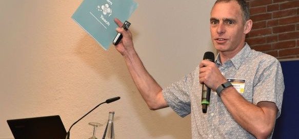
UNIGIS Fellow: Ian Heywood
The UNIGIS board of directors has decided to award the distinction of “UNIGIS Fellow” to Dr Ian Heywood – congratulations! Ian had been involved in key capacities with UNIGIS UK (Manchester) and UNIGIS International since its inception, and always played an important role as an innovator contributing many key concepts and strategies to the development of this still-unique international network of universities dedicated to online distance learning in Geoinformatics. While he is still recognized in the GIS community for his well established introductory textbook, he since has moved on to fields like innovation and entrepreneurship, and ‘up’ to the more …
Read more…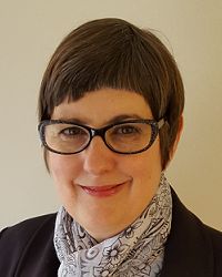
Ann Olivier named ‘UNIGIS International Fellow’
At the recent UNIGIS International network meeting, the UNIGIS board of directors unanimously decided to award the distinction of “UNIGIS Fellow” to Ann Olivier – congratulations! Ann had started her involvement with UNIGIS at the (then) Port Elizabeth Technikon, quickly developing their UNIGIS program into a highly regarded professional qualification. Over many years and through many structural changes, Ann Olivier was recognized as the ‘heart and soul’ of UNIGIS in South Africa. Numerous students owe their successful graduation to the motivation and support provided throughout their study program, and beyond: many successful geospatial careers would not have been possible without …
Read more…
Rafael Beltran recognized as ‘UNIGIS International Fellow’
The board of the UNIGIS International Association (UIA) is honoured to announce the nomination of >Rafael Beltran Ramallo (Bolivia) as a Fellow. Above and beyond his roles as an instructor and consultant for the >UNIGIS Latin America programs, Rafael Beltran is a highly visible and acknowledged ambassador for UNIGIS and contributes through his active >social media presence. Congratulations to this distinction on behalf of the entire global UNIGIS community – we all are looking forward to continue working with you towards “Educating GIS Professionals Worldwide! “UNIGIS International Fellow” – it is a distinction awarded by the >UNIGIS International Association (UIA) for UNIGIS …
Read more…
u_Lecture: ‘Geo-Entrepreneurship’ – Nov 23
Registration is still open for the upcoming free webinar on ‘Geo-Entrepreneurship: Using Location to Enhance Your Competitive Advantage’ presented by Dr Ian Heywood from the University of Aberdeen Business School. For details and to sign up > https://attendee.gotowebinar.com/register/8304017966904333316
Read more…
Top award for UNIGIS América Latina Director Richard Resl
Jack Dangermond with Richard and Domingo on stage During the plenary session of this year’s Esri User Conference (see link at bottom for bilingual slides), Richard Resl and Domingo Ankuash received the ‘Making a Difference’ award from Esri’s Jack Dangermond. This distinction highlights their work towards preserving Amazonian Indians’ land rights and livelihoods. Domingo’s present to Jack Dangermond: ‘maps serving as our spears’ Through the AmazonGISnet initiative the territories of indigenous groups are documented to preserve this native and pristine environment for their next generations. After being applauded by the 15000 strong audience for their impressive talk, Domingo presented a ceremonial …
Read more…
Trimble providing software support to UNIGIS students
Trimble’s Hans-Jürgen Gebauer and Prof Josef Strobl signing agreement Today at the GI_Forum conference in Salzburg, Trimble Navigation Limited and UNIGIS International concluded an agreement offering complimentary licenses to all registered UNIGIS distance learning students worldwide. Under the terms of this agreement, students have free access to eCognition, INPHO, UAS Master, Pathfinder Office, SketchUp Pro and further software technologies for their study assignments and thesis development. Though best known for GPS technology, Trimble integrates a wide range of positioning technologies including GPS, laser, optical and inertial technologies with application software, wireless communications, and services to provide complete commercial solutions. Its integrated …
Read more…
Academic Excellence Prize awarded at GI_Forum
Heidi El Hosaini (UNIGIS Manchester) had been named the winner of the annual worldwide UNIGIS Master Thesis competition in October 2014 for her dissertation titled “Locating and positioning solar panels in a 3D city model – a case study of Newcastle”. This thesis was developed with sponsorship from the UK Ordnance Survey. The prize carried an invitation to the GI_Forum Salzburg, where she published and presented her work in a well received talk in the main conference program, and received the ‘trophy’ and an award certificate. The winner says: “My dissertation demonstrates potential applications and techniques using Ordnance Survey’s 3D …
Read more…
AGIT / GI_Forum – annual UNIGIS meeting place!
Staying up-to-date professionally requires a focus on two things: following new developments in geospatial technologies and methods, and to be well connected in a network of peers. Both objectives are well supported through our annual pair of conferences, AGIT and the English language GI_Forum. Outstanding keynotes provide inspiration and perspective. With a rich program of workshops, paper presentations and tutorials, the choices of relevant and timely continuing education offerings sometimes are hard, but rewarding. The presence of UNIGIS alumni from all over the world, and from every vintage provides an excellent opportunity to enhance one’s network, of course assisted by a diversity …
Read more…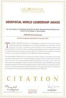
UNIGIS receiving ‘Geospatial Institution of the Year’ award
At this week’s Geospatial World Forum in Lisbon, the worldwide UNIGIS organisation as a network of academic partner institutions offering graduate qualifications in Geoinformatics was presented with the ‘Geospatial Institution of the Year’ award, recognizing our leading role in ‘Educating GIS Professionals Worldwide’. Prof Marco Painho from UNIGIS Portugal and Dr Shahnawaz from UNIGIS India joined UNIGIS Int’l chair Prof Josef Strobl accepting this award during the Geospatial World Awards Gala evening on May 27.
Read more… Next