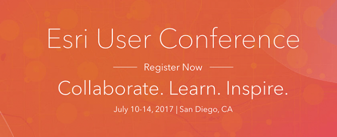
July 8-14 | UNIGIS at the ESRI User Conferences
Meet UNIGIS at the ESRI User Conferences Meet UNIGIS at the biggest GIS event of the year, the Esri User Conference in San Diego. From July 8th until July 14th, you can find UNIGIS in the different exhibition areas during the Esri User Conference: July 8-11 at the Esri Education GIS Conference July 10 at the Esri Academic GIS Program Fair table July 10-14 at the Esri User Conference booth We look forward to an exciting event together with you! More information >>
Read more…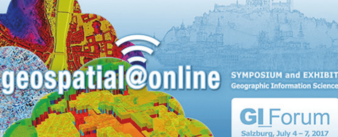
July 5-8 | GI Forum Salzburg
GI_Forum 2017 – geospatial@online GI_Forum 2017 provides a platform for dialogue among geospatial minds, creating an informed GeoInformation Society. Our motto ‘geospatial@online’ focuses on the universal and pervasive introduction of geospatial concepts and methods: have we completed the transition to online GI Services? Are we ready for GI Services 2.0, i.e. dynamic applications built on existing GI Services? Do we educate for these developments at school level? GI_Forum 2017 addresses such questions in the context of big data, sensors, real time data streams, geodata infrastructures and cloud computing, bearing in mind perspectives from a variety of domains. Paper presentations as well as …
Read more…
February 1 | U-Lecture webinar Geospatial Information Licenses for Non-Lawyers
February 1 | U_Lecture webinar Geospatial Information Licenses for Non-Lawyers This UNIGIS Webinar by Kevin D. Pomfret will be held on Wed, Feb 1, 2017 5:00 PM – 6:00 PM CET – The geospatial community (government agencies, industry, universities, NGO’s) are increasingly creating geospatial products and services by aggregating a wide range of datasets from a variety of sources. In many instances this data is licensed from one party to another, not sold. A geospatial information license does more than transfer rights in geospatial information from one party to another. It is a legal document that allocates operational and legal …
Read more…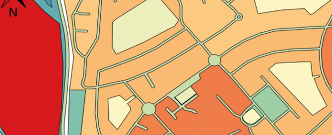
1st place: Tim Hernon – UNIGIS UK
The winner of the Academic Excellence Prize for 2016 is Tim Hernon (UNIGIS UK). His thesis showed a novel approach to extract urban land use data from Volunteered Geographic Information (in this case, OpenStreetMap data), successfully tested and discussed in detail for a case study in Nottingham, UK.
Read more…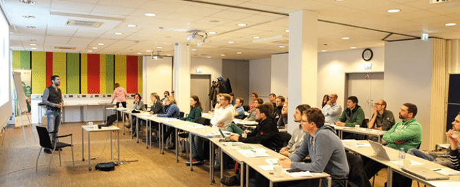
UNIGIS MSc 2016 workshop – Let´s talk about place …
… and a wide variety of issues and topics regarding distance education with a focus on the conception of the Master Thesis. That´s how you could summarise the 2nd UNIGIS MSc 2016 workshop held in Salzburg from 1 to 2 December 2016. The mix of representatives from industry and research creates ideal opportunities for a professional exchange of ideas on a scientific basis.
Read more…
December 14 | U_Lecture webinar ‘3D data capture with LiDAR’
December 14 | U_Lecture webinar ‘3D data capture with LiDAR’ Registration now is open for the u_Lecture webinar presentation by Christian Sevcik on Dec 14 at 5pm CET. Register here >>> This lecture is a about current LiDAR technology and its various applications: gain insights how point cloud data is acquired and derived with Waveform LiDAR sensors. We will shed some light on what it takes from sending out a laser pulse to a point with 3D coordinates. Learn about the latest trends in the LiDAR industry, from UAV operation, to multichannel and multispectral LiDAR and see some of the …
Read more…
December 2-3 | Workshop: Geo-Entrepreneurship
December 2-3 | Workshop: Geo-Entrepreneurship Using Location to Enhance Your Competitive Advantage. Build up your skills to bring your Geo-idea to the market! In this 1.5 day workshop you will be introduced to a range of techniques used by ‘startups’ to help develop your own geo-enabled business idea. You will learn the steps you need to take to identify and develop your idea, secure customers, and find market opportunities. The participants of this workshop will be GI professionals, UNIGIS/Geo- students and alumni who want to bring their own GI-project to life, or get a new business idea off the ground. These …
Read more…
2nd place: Nathan Novak – UNIGIS USA
The first runner up is Nathan Patrick Novak (UNIGIS USC) who proposed an elaborate modelling of Sperm Whale habitats within the Central Gulf of Alaska, using a range of geospatial data. You can read his thesis here.
Read more…
November 23 | U_Lecture webinar Geo-Entrepreneurship
November 23 | U_Lecture webinar Geo-Entrepreneurship Wednesday 23 November 2016: “Geo-Entrepreneurship: Using Location to Enhance Your Competitive Advantage” Dr Ian Heywood, Condesys Consulting The importance of geography, or specifically ‘location’, is firmly back on the agenda as a business development opportunity for many companies. Knowing where customers, assets or employees are located has always been important, but with the growth in ‘location aware’ mobile devices, that can monitor location in real time and share this information across social networks, new disruptive business opportunities are possible. During this webinar Ian will be exploring, why now more than ever, new ‘Startups’ are leading …
Read more…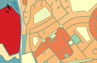
Winners of the UNIGIS Academic Excellence Prize 2016
The UNIGIS International Association (UIA) announces the winners of its Academic Excellence Prize 2016. The Prize, initiated in 2008, is presented to the students submitting the best (English language) MSc thesis during the academic year and are nominated by their UNIGIS sites. This year the competition was extremely tight with seven excellent high quality MSc theses being shortlisted by the Review Panel. In the end the panel decided to make three awards. The winner of the Academic Excellence Prize for 2016 is Tim Hernon (UNIGIS UK). His thesis Map section used by winner Tim Hernon for his case study in Nottingham, UK. …
Read more… Next