
UNIGIS Salzburg – Communication matters
“Especially in distance study programs like UNIGIS a key factor of personal success is getting to know fellow students in the beginning and to develop a culture of discussion and mutual support in learning processes” explained Prof. Josef Strobl, Director of UNIGIS Salzburg and Chair of UNIGIS International to a group of 14 new UNIGIS professional students participating in an introductory workshop last weekend in Salzburg. At latest by the dinner in a traditional pub in the city center the ice was broken. No matter if this was a result of the mentioned advice or just a natural consequence of …
Read more…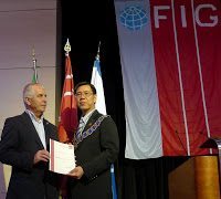
UNIGIS now an Academic Member of FIG
The 35. FIG (International Federation of Surveyors) Working Week was held in Rome from the 6th to the 10th of May in 2012. The motto of Italian Working Week is “Knowing to manage the territory, protect the environment, evaluate the cultural heritage”. 500+ papers have been accepted for presentation in Rome in almost 100 sessions, forums and workshops (http://www.fig.net/fig2012/downloads/tech_prog.pdf). Many of the papers are peer reviewed and published soon at the Surveyors Reference Library (http://www.fig.net/srl/). The FIG Council has admitted UNIGIS International Association as an academic member of FIG. The Certificate of Academic Membership was presented by FIG President, CheeHai …
Read more…
Next UNIGIS course for Central Asia students
The UNIGIS study centre for Central Asia at ACA*GIScience in Bishkek has now opened the registration period for the next intake of distance learning students, starting with October 2012. Applications will be accepted until September 10, and candidates are expected to have a background in any ‘spatial discipline’ or experience in a GIS application domain. UNIGIS Central Asia offers tutoring in Russian language, but as an international program requires profound English language skills for working with study materials, complete assignments and communicate within the worldwide network of UNIGIS students and alumni. With a clear focus on continuing education for geospatial …
Read more…New students in Ecuador and Colombia
By the end of April, the UNIGIS site in Quito welcomed 70 new students from Ecuador, Colombia and other Latin American countries as new members of the UNIGIS community of learning. They will join of group of 250 active students that already are enrolled at the University San Francisco de Quito in Ecuador. Being part of an academic program that is tailored to the specific needs of GIS professionals in the emerging GIS-market between Patagonia and the Rio Grande opens up great opportunities for professional and personal development. Welcome – Bienvenidos!
Read more…UNIGIS programmes launched in Nepal!
UNIGIS@Kathmandu (NEPAL) takes pride in announcing the first open admissions period for the UNIGIS professional diploma and UNIGIS MSc in Geographical Information Science and Systems. The two UNIGIS study programmes are being offered in Nepal by the Kathmandu Forestry College in collaboration with the Centre for Geoinformatics (Z_GIS), University of Salzburg, Austria. The academic certification / degree will be awarded by the University of Salzburg, Austria. The Ministry of Education, Govt. of Nepal has already confirmed their endorsement of UNIGIS qualifications. This academic collaboration between Nepalese and Austrian institutions aims at providing internationally standardised high quality Geoinformatics and GIScience education to …
Read more…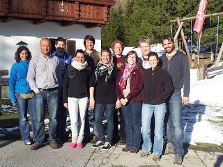
UNIGIS Team Salzburg – Work Retreat
The UNIGIS Team Salzburg held a work retreat on April 12.-13., 2012, to discuss in depth the strategic development of two UNIGIS cornerstones: An entire day was dedicated to reflect on the current status of UNIGIS modules and future paths to take. A particular focus was given to the alignment of content and materials between the two languages (German and English) and where adequate also between the two UNIGIS programmes (UNIGIS professional / UNIGIS MSc). To provide guidance on content development in terms of syllabi and adequate learning materials and -media several team members take a role as ‘theme lead’ …
Read more…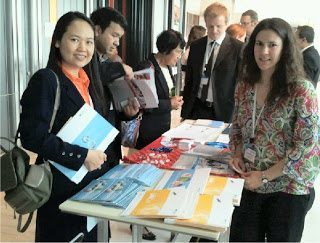
UNIGIS participated in ASEMUNDUS Seminar!
The ASEMUNDUS Networking Seminar co-financed by the European Commission under Erasmus-Mundus programme was orgnised in Bangkok, Thailand on 2nd and 3rd April, 2012.Dr. Shahnawaz (Director S/SE Asia, UNIGIS International) was invited to the seminar and he informed the participants about UNIGIS network in general and UNIGIS initiatives in the region in specific. The seminar participants were highly impressed with the UNIGIS philosophy of ‘Educating GI-professionals Worldwide’ and several institutions enquired about the possibilities of becomming a part of this excellent network offering GIScience education through online distance learning programmes.
Read more…
GISopen conference in Szekesfehervar: a qualitative contribution from UNIGIS graduates.
The GISopen conference was initiated in 1997, just after the first UNIGIS intake was graduated from the University of West Hungary, Faculty of Geoinformatics. The annual GISopen conference is the longest GI related conference series in Hungary. The main aim is to involve the faculty alumni into the active lifelong learning process, to give a forum for the ex-students and to offer them an opportunity to share their experience after several years of professional activity. From 12 to 14 of March 2012, the 16th GIS open conference was organised in Szekesfehervar. The number of participants was 200+ like in the …
Read more…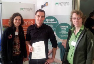
UNIGIS graduate winning top award at RTM!
Each year, the „Runder Tisch GIS“ at the Technical University of Munich awards prices for top theses in Geoinformatics. Outstanding Bachelor and Master Theses as well as PhD Dissertations compete for this distinction, with winners being announced and their work presented within the framework of the annual “Münchner Fortbildungsseminar Geoinformationssysteme”: Today, UNIGIS Salzburg alumn Matthias Boedecker received the 1st prize for his excellent Master Thesis “Koordinierung thematischer Klassen unter Verwendung kartographischer Relationen” (see summary). Congratulations, Matthias, for this success, combined with best wishes for your professional future!
Read more…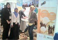
UNIGIS in Malaysia!
Facilitating an ongoing process of integrating institutions from Southeast Asia into the international UNIGIS network of universities, UNIGIS representatives again participated in this year’s Malaysia Geospatial Forum organised at Melaka, Malaysia on 6th and 7th March, 2012. Dr. Shahnawaz (Director, UNIGIS S/E Asia) managed an exhibit booth shared with Geomatika College International, as well as organised a series of workshops for students, teaching faculty as well as professionals engaged at various institutions and organisations.
Read more… Previous Next