
Open Web Services & Web Mapping Applications Summer School Girona
From 9th to 13th of July 2012 will take place the 3rd Summer School dedicated to Opensource GIS in Girona, organized by SIGTE of the University of Girona, and the collaboration of OpenGeo and the Geospatial Institute of the University of Nottingham.From the start, the aim of this initiative to meet the GIS professional demands related to free and open solutions. The Summer School 2012 will be focused on the development and creation of Open Web Mapping Services and Web Applications. If you are interested in application development and creation of web map services using the most widely used free …
Read more…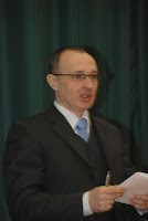
Top academic credentials for UNIGIS Hungary alumnus
Ervin Pirkhoffer PhD (UNIGIS alumnus, 2004-2006) held his habilitation (’second doctorate’) lectures at the Faculty of Sciences, University of Pécs on February 16. The titles of the lectures were ”GIS Approaches in Modelling” (lecture for students) and ”Flash Flood Modelling” (scientific presentation in Hungarian and in English). After acceptance of his professorial thesis, Ervin Pirkhoffer presented a scientific lecture on general features of flash floods and the impact of climate change on flash flood frequencies and magnitudes. Among the broad range of modelling approaches, he emphasized the findings of his research group. He outlined the strenghts of GIS applications in …
Read more…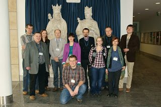
New edition of UNIGIS studies started at Jagiellonian University, Poland.
Last weekend students of intake 2012 arrived to Kraków to take part in their first two-day UNIGIS workshop.First day was dominated by rather non-GI issues like studies program and organization as well as e-learning educational and technical aspects. In the afternoon students were encouraged to build “learning alliances” by getting know each other during students’ self-presentation and common dinner in one of restaurants in the Kraków Old Town.Second day was devoted mainly to GIS software used during the studies, which was presented and tested by students in the computer laboratories of Institute of Geography and Spatial Management.We hope that students …
Read more…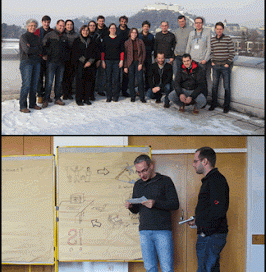
Once again: UNIGIS professional attracts practitioners from near and far.
After a very successful last year in terms of student registrations for the UNIGIS professional certificate in Salzburg, the popularity of this application-oriented GIS study program offered by the Centre of Geoinformatics is continuing in 2012. Most of this year’s first group of students attended the introductory workshop a few days ago to ‘dive into’ an innovative and partly unfamiliar learning environment, and getting to know fellow students and UNIGIS faculty. The broad range of participants’ background domains indicate the integrative character of spatial information science. Beyond that, a stimulating atmosphere for collaborative learning not only for students, but for the entireUNIGIS …
Read more…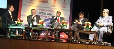
Directions of Geospatial Technology – India Geospatial Forum
At this year’s India Geospatial Forum in Gurgaon, Feb 7-9 Prof Josef Strobl from UNIGIS International was invited to the Plenary Panel on ‘Dimensions and Directions of Geospatial Technologies’. In a session joined by Dr. V K Dadhwal (Director NRSC India); Rajesh Mathur (Vice Chair ESRI India) and J. B. Monnier (Senior VP Bentley Asia), Prof Strobl was presenting ‘Live Geography’ as one of the key trends in today’s geospatial developments. India’s leading Geoinformatics event did not only again succeed in bringing together top decision makers, scientists and business representatives, but presented a rich industry exhibit and served as a reference platform …
Read more…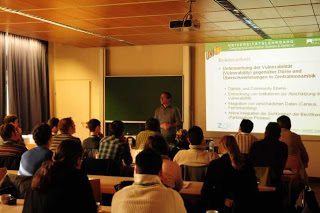
UNIGIS MSc: 2012 class is taking aim …
… at reaching their objectives! After having started their studies earlier this year, more than 50 new MSc candidates are convening at the University of Salzburg for their getting-acquainted workshop. A mixed agenda of introductions, orientation sessions on curriculum / modules / learning platform / approaches to study, plus reflecting on motivations and objectives for their studies keeps everybody involved. The main objective of the workshop of getting everyone off ‘to a good start’ into their UNIGIS MSc studies requires a clear focus on establishing communications and building a ‘community of learning practice’. This year’s group again has a diverse …
Read more…UNIGIS joining FIG as Academic Member
UNIGIS is proud to announce that at the latest Council Meeting of the International Federation of Surveyors (FIG), the Council decided to welcome UNIGIS as an Academic Member. FIG was founded in Paris in 1878 and is the premier international organization representing the interests of surveyors worldwide. It is a federation of the national member associations and covers the whole range of professional fields within the global surveying community. It provides an international forum for discussion and development aiming to promote professional practice and standards. Academic membership links universities or their faculties or departments, that are responsible for surveying education …
Read more…
UNIGIS Int’l: Thanks to Anna Szukalska!
Anna Szukalska from Krakow has managed the UNIGIS International Office for four years, coordinating meetings, communication and processes across all UNIGIS partner universities. In addition to managing external liaisons with industry partners and membership in associations, she assisted with marketing and ‘kept the wheels spinning’ when everyone else seemed to be busy with other tasks. With the end of 2012 Anna will hand over her responsibilities at UNIGIS International to her successor, and focus on her work at UNIGIS Poland. We will miss her motivating spirit and sense of duty, leading our Association into many initiatives which were not feasible before. UNIGIS Chair …
Read more…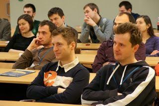
UNIGIS workshop of intake 2010 in Kraków, Poland.
Last weekend almost 50 students of UNIGIS intake 2010 arrived to Kraków to take part in their fourth and last UNIGIS workshop. They were eager to meet each other and to strengthen their learning motivation for last three months of their studies.Apart of the practical classes in remote sensing they attended lectures discussing new trends in GISience and worked in groups on the collaborative project issues.Equally important to the ‘GIS’ part of thee workshop were more pedagogically oriented classes dealing with students learning styles, their feedback regarding UNIGIS obligatory modules and showing the results achieved by group and each student. …
Read more…
Geospatial World Forum 2012 – UNIGIS as Co-Sponsor!
UNIGIS International is a Co-Sponsor of the Geospatial World Forum’ 2012 which will be organised from 23rd to 27th April, 2012 in Amsterdam, Netherlands.Josef Strobl (Chair, UNIGIS International) has been invited to share his ideas, experiences and vision about ‘Evolving Industry-Institution Network for Capacity Building’ in GIScience & Systems. This exclusive session involves several eminent speakers including A P J Abdul Kalam (11th President, Republic of India) and Jack Dangermond (Founder and President, ESRI Inc., Redlands, California, USA). As the premium global geospatial industry event, Geospatial World Forum will bring various stakeholders, service providers, policy makers as well as users …
Read more… Previous Next