U_lecture April 25 6-7pm CET: Mapping Wilderness by Dr Steve Carver
GIS approaches to mapping wilderness: quantifying the qualitative Monday 25 April 2016, 6-7 PM (CET)Dr Steve Carver, Senior Lecturer, University of Leeds Free web lecture Register here Throughout early human history, wilderness has been a place of fear and dread, of wild beast and wilder people, often shown on old maps as “Parts Unknown” or “Hic Svnt Dracones” (Here be dragons). More recently these blank spots have acquired a certain romance and the word wilderness has become more closely associated with unspoilt nature and the sublime. In the modern world there are no remaining blank spots on our maps as satellites …
Read more…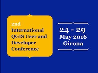
2nd International QGIS User and Developer Conference Girona (Spain) 24-29 May
This year, the Spanish FOSS4G (Jornadas de SIG Libre) organized by SIGTE (University of Girona) will held the 2nd edition of the International QGIS User and Developer Conference, as well as a QGIS Hack Fest. The conference will take place in May 2016 (24th-29th). During a whole week Girona (Spain) will be the capital of the Free and Open Source Geospatial Technologies. The International QGIS User and Developer Conference wants to be the referential conference, and a meeting point for the family of users and developers orbiting around the QGIS project, in order to gather experiences and sharing knowledge about QGIS. …
Read more…
UNIGIS Portugal / NOVA IMS First International GEOINT Program to Achieve USGIF Accreditation
NOVA Information Management School of the Universidade Nova de Lisboa (NOVA IMS), located in Lisbon, Portugal, has been added to the growing list of USGIF-accredited GEOINT programs. Through the USGIF Academic Accreditation program, colleges and universities around the globe have the opportunity to receive accreditation of their geospatial intelligence programs accompanying a college degree. Students who meet high academic standards and graduate from accredited programs receive USGIF’s GEOINT Certificate, which helps ensure the GEOINT Community has a robust workforce now and in the future. To date, nearly 600 students have graduated with USGIF GEOINT Certificates. NOVA IMS is the first non-U.S. school to receive USGIF academic accreditation. The inclusion of NOVA IMS represents a major step for USGIF and signals the broadening of GEOINT as …
Read more…
Summer School opportunity: Smart Cities
21 – 29 August 2016 at TU Wien The concept of Smart City is promising: The European Innovation Partnership on Smart Cities and Communities highlights the opportunities to link and upgrade infrastructures, technologies and services in key urban sectors (transport, buildings, energy, ICT) in a smart way [that] will improve quality of life, economic competitiveness and sustainability of cities. Such conceptions present Smart City-solutions as mainly technology driven utopian visions of societal transformation while blurring the multitude of social decisions made in technology development which fundamentally shape the kinds of social transformations possible in urban life. The Summer School brings …
Read more…
GI Forum 2016 Call for Posters Deadline May 1st
This year’s GI_Forum motto is “open : spatial : interfaces”. Take the opportunity to actively shape the program of the GI_Forum by presenting your work as part of our poster session. A poster presentation is a great way to present your work to a broad audience of professionals from different fields. For details see http://gi-forum.org/poster. SPECIAL RATE of € 220,- for active UNIGIS Students The special rate includes all events of the GI_Forum and the German-language counterpart, AGIT. Registration is open until June 25, 2016! Follow this link to register: http://gi-forum.org/registration.
Read more…
Enter your Hexagon Smart M.App in the IGNITE competition!
The deadline for the Hexagon IGNITE Challenge is May 1st. We encourage our students to participate in this contest and create the M.App of the future. Please contact your local UNIGIS Coordinator about this challenge if you are looking for partners and ideas. More information
Read more…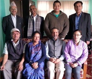
UNIGIS Workshop in Kathmandu!
An intensive workshop with alumni, current students and instructors of UNIGIS@Kathmandu was organised on 13-14 March, 2016 at Kathmandu Forestry College (KAFCOL), Nepal. The workshop focussed on two major objectives: 1. enhancing interaction among the above mentioned three groups for exchanging best practice and experiences for effective online learning, and 2. establishing an effective approach towards writing a high quality Master Thesis. UNIGIS Kathmandu board members Dr. Shahnawaz (Director, UNIGIS S/E Asia) and Dr. Ram Asheshwar Mandal (Coordinator, UNIGIS@Kathmandu) moderated the workshop as well as presented examples of ‘good practice’ from other member within the UNIGIS International network. They also emphasised that …
Read more…
Call to join The Indonesian Peat Prize to establish a national standard for mapping peatlands
The Indonesian Peat Prize is an ambitious, collaborative prize for finding a more accurate, faster and affordable method of mapping the extent and thickness of Indonesian peatlands. A $1 million prize purse will be awarded to the winning team along with their invaluable contributions to establishing a better national standard for mapping peatlands in Indonesia. Students, engineers, consultants, product directors, scientists, research institutions, companies, universities, civil society organizations, non-governmental organizations—anyone with a great idea who meets the criteria is invited to join. People or teams from around the world can join forces with Indonesian partners. The prize is hosted …
Read more…
UNIGIS UK presents new U_Lectures spring 2016
UNIGIS UK has published the new U_Lecture series for the spring 2016 season. Interesting topics and speakers have been selected such as disease ecosystems in Tanzania, mapping wilderness, and assessing land degradation and desertification. In the first U_Lecture on March 29th, Rachael Reynolds shares here insights about examining the impact of climate change upon disease ecosystems in Tanzania. More information about the webinar schedule and registration.
Read more…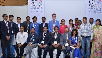
UNIGIS promoting Youth Forum at GSI’2016, Noida!
The UNIGIS@India team led by Dr. Shahnawaz (Director, UNIGIS S/E Asia) played a prominent role in this year’s ‘GeoSmart India’ conference and exhibition held from 1st to 3rd March, 2016 at the India Expo Centre and Mart, Greater Noida, India. UNIGIS coordinated a full day ‘Youth Forum’ on March 2nd, focussing on geospatial capacity building. More than 50 young students and entrepreneurs, eminent academics, prominent industry leaders and successful professionals joined the forum and shared their rich experiences with geospatial education, research, applications and employment opportunities. (The presenters and the prize winners with UNIGIS Team at Youth Forum) UNIGIS has introduced …
Read more… Previous Next