“Welcome to UNIGIS” Movie
Talking with GIS professionals, academics and UNIGIS students and alumni, the UNIGIS movie wants to introduce the key points about why GIS is important in our society and why GIS professionals are strongly needed nowadays.The highlights of this movie are: The key role of GIS in our society. The introduction and implementation of GIS in business organizations and institutions is almost essential because of the added value and knowledge provided. There is a wide range of fields for GIS applications UIA & UNIGIS Programme. UNIGIS is the largest and best-established eLearning GIS programme in the world. Each year we enroll …
Read more…
UNIGIS Sub-Saharan Africa PLATO Accreditation
The South African Council for Professional and Technical Surveyors (PLATO) has accredited the UNIGIS professional and MSc courses as complying with their requirements for registration. The Professional and Technical Surveyors Act 40/1984 requires PLATO to accredit academic courses at educational institutions in order for graduates to register in the various PLATO categories. The UNIGIS MSc in GIScience now has been accredited as complying with the requirements for registration as a “Professional GISc Practitioner”, and the UNIGIS professional Diploma is accredited as complying with the requirements for registration as a “GISc Technologist”. This opens up attractive professional pathways and recognized credentials …
Read more…UNIGIS Academic Excellence Award 2012
During the UNIGIS International annual network meeting, held this year in Salzburg, Austria, the 2012 winner and runners up in the UNIGIS Academic Excellence prize, awarded to the networks top Master’s theses, were announced: First Place, and Winner of the Academic Excellence Award – Samuel KRUEGER (UNIGIS – University of Southern California), for a thesis entitled: Delimiting the postmodern urban center: an analysis of urban amenity clusters in Los Angeles. See USC news release! Second Place – J P GLUTTING (UNIGIS – Amsterdam), for a thesis entitled: Excess heat-related mortality in micro-urban heat islands: a case-only study in Barcelona. Third Place – Agnieszka WYPYCH …
Read more…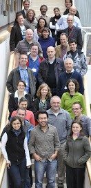
UNIGIS International network conference in Salzburg
From Oct 24-28, more than 30 representatives from UNIGIS partner universities and study centres worldwide met in Salzburg, Austria for their annual coordination conference. Three full days were dedicated, respectively, to advancing best practice in Geoinformatics distance learning, enhancing cooperation with the geospatial software industry, and to the management and future direction of the UNIGIS network. With hundreds of graduates each year, and thousands of highly qualified alumni, UNIGIS is making a substantial contribution to the success of a ‘geospatial view’ across many disciplines and industries. The model of a ‘Virtual University of GIScience’, integrating the teaching capacity and competence …
Read more…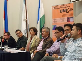
UNIGIS@ University ICESI, Colombia
In order to deepen the recently established cooperation between UNIGIS in Latin America and the University ICESI, Colombia (http://www.icesi.edu.co), both organizations jointly organized a well-attended GI-symposium at the ICESI campus in Cali. Nearly 200 attendees discussed challenges and opportunities for GIS-practitioners in Colombia with a specific focus on GI-education. On behalf of the UNIGIS team in Latin America we would like to express our sincere thanks to all participants and to the staff of our partner university in Colombia for their participation and collaboration!
Read more…
The 15th edition of UNIGIS Girona Profesional Master starts!
This 15th UNIGIS Girona edition has more than 40 new students who become part of the worldwide UNIGIS community. Year after year, the number of registration notes the success of our Programme, adapted to the emerging needs and demands more professional environment GIS. We train professionals capable of managing, implementing and developing Geographic Information Systems to address and resolve the needs and demands of the professional world. UNIGIS Girona team will work hard in order to guarantee the success and recognition of UNIGIS training offer. UNIGIS Girona website
Read more…
Science for Sustainability UNIGIS alumni (and other) doctoral students might be interested in this International Scientific Conference for PhD Students to be held at the University of West Hungary – Győr, Hungary, March 19-20, 2013 Talentum Project TÁMOP 4.2.2.B-10/1-2010-0018 See more at : www.nymetalentum.hu/phdconf As a part of its talent management program, the University of West Hungary is organizing an international PhD conference in order to provide an opportunity for Hungarian and foreign PhD students to exchange views in the presence of distinguished academics and researchers from several disciplines. Target audience: Hungarian and foreign PhD students. The scientific hosts of the …
Read more…
LiDAR Intensive Programme
Event announcement – LiDAR Intensive Programme This short intensive programme on the state of the art in LiDAR science, methods and technologies is organized and hosted by the University of Salzburg, Department of Geoinformatics – Z_GIS with the support of the innovative European LiDAR Mapping Forum (www.lidarmap.org/ELMF). The course is designed around and closely integrated with the leading European LiDAR event, bringing top visionaries, key developers and technology representatives into an intensive, small group learning environment. We invite graduate students, young researchers and junior staff with a focus on research, development and applications involving LiDAR technologies and methods. Sponsors from …
Read more…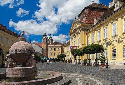
Professor Josef Strobl has been awarded an honorary doctorate (doctor honoris causa) by the University West Hungary, Faculty of Geoinformatics for his significant contributions to education, research and networking on geoinformation science and technology. His contribution has substantially improved e-learning solutions in this field and its applications. The award ceremony will take place on 14 Sep 2012 in Szekesfehervar in the opening session of the 50th Anniversary of the Faculty. Szekesfehervar the town of Kings, where the Hungarian kings were crowned in the middle ages. The city hosts the school of surveying and land management from 1972. The first department …
Read more…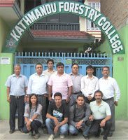
Nepal mapped on UNIGIS International network!
Nepal secured its location on the map of the UNIGIS International network last week after UNIGIS@Kathmandu welcomed its first batch of 10 students. An orientation workshop was jointly conducted by Dr. Shahnawaz (Director S/E Asia, UNIGIS International) and Dr. Krishna Poudel (Coordinator, UNIGIS@Kathmandu) from 1st to 4th August, 2012 at the host institution Kathmandu Forestry College (KAFCOL). The opening session of the orientation workshop was attended by about 30 participants including current and potential UNIGIS students, top administration of KAFCOL and several senior officials from various national and international agencies in Nepal. The Principal of KAFCOL, Dr. Bishnu Hari Pandit, …
Read more… Previous Next