
UNIGIS at Geospatial World Forum
UNIGIS is again supporting the biannual Geospatial World Forum in Hyderabad as a key ‘knowledge partner’. During award night, Prof Josef Strobl spoke on behalf of the selection jury before prices were handed to recipients by the Chief Minister of Gujarat, Narendra Modi. Students, graduates and everybody interested in UNIGIS education is meeting at the UNIGIS booth in the exhibit area, representing all partner institutions within UNIGIS India: the Universities of Goa and Chandigarh, as well as AIILSG offering UNGIS professional from various locations. As the leading educational organisation at the Geospatial World Forum, UNIGIS is coordinating and leading the ‘Integrated …
Read more…
Top academic honours for UNIGIS Hungary alumnus
On Nov 30, Peter Gyenizse (UNIGIS Hungary 2004) successfully finished his habilitation process, the highest level of academic qualification in his country. The presentation of his scientific work is titled “An investigation of the physical and social impacts on the urban development of Pécs using GIS”. Pécs, the most populous city of Southern Transdanubia (Southwest-Hungary), is located on the southern foothills and slopes of the Mecsek Mountains and in the bottom of the Pécs Basin. P. Gyenizse’s study applies GIS methodology to explore the major physical and social potentials and their influence on the urban environment. During the last fifteen …
Read more…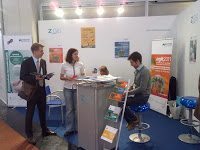
UNIGIS at Intergeo Trade Fair, Cologne
The UNIGIS Salzburg team is advising prospective students in their MSc and professional certificate programs at this year’s Intergeo exhibit on Cologne, Germany. Interest in obtaining a widely recognized advanced qualification in Geoinformatics / GIScience continues to draw numerous visitors. At this increasingly international event Asia plays an important role, very much in line with the overall development of the UNIGIS program. Of course, as always, the UNIGIS booth is an important meeting place for the many UNIGIS alumni working at Intergeo or just attending the exhibits.
Read more…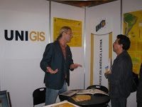
1st Latin American GIS education conference
On September 21st, UNIGIS co-organized the first Latin American Conference on GIS-Education (http://www.sigsa.info/lauc2010/edu.html) in cooperation with ESRI. The conference was hosted by ESRI’s Mexican representative SIGSA (http://www.sigsa.info) and brought together GIS-users, teachers and other faculty from all over Latin America. A curriculum development workshop was held by the director of the UNIGIS program in Latin America, Richard Resl from the University San Francisco de Quito, Ecuador. Nearly 200 participants discussed common goals and challenges for developing and implementing up-to-date GI curricula that satisfy the specific needs of students and professionals in order to meet the growing demand for high quality …
Read more…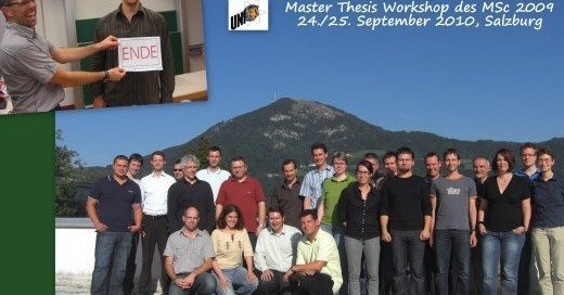
Master Theses Workshop
UNIGIS Salzburg students were attending a September 24/25 workshop presenting and discussing their thesis projects. More than 20 topics ranging across a variety of application domains, from a methodology focus to systems implementation and from business cases to educational perspectives demonstrated the enormous width and depth of GIScience! The UNIGIS Salzburg team is wishing everybody well with the final stages of their MSc thesis – and congratulates Thomas Purfürst who was first with submitting his work on GNSS signal quality under forest canopy.
Read more…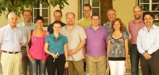
UNIGIS Annual Partner Conference
This year, UNIGIS partner universities are convening at ISEGI in Lisbon, Portugal for their annual network coordination conference. Topics like curriculum and learning media development are on the agenda just like joint summer schools, credit transfer and enhancements for the worldwide community of UNIGIS alumni. With the UNIGIS network approaching its third decade of providing distance learning to GIS/GIScience professionals around the world, its reach now has expanded to all continents and student numbers continue to grow at an impressive pace – testimony to the high quality of education recognized across the GIS industry and all application domains. UNIGIS chair …
Read more…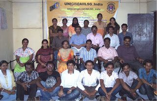
UNIGIS Orientation / Promotion workshop in India
“The appreciation and recognition of the UNIGIS network of GIScience education is increasing among students from various disciplines in India“ says Dr. Shahnawaz (Director S&SE Asia, UNIGIS International). This conclusion is based on the educational backgrounds of 26 students and 3 teachers / professionals participating in the UNIGIS orientation workshop organised at the UNIGIS AIILSG study centre, Cochin, Kerala (www.unigis.net/aiilsg_india) on 4th September, 2010. Most of the the participants in this one-day workshop are pursuing postgraduate studies in oceanography, environmental science and geography at various colleges in Kerala.After open-floor discussions with the participants, Mr. V. Govindankutty (Coordinator, UNIGIS@AIILSG_India) concluded that many …
Read more…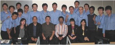
UNIGIS Faculty Workshop – Indonesia
Within the context of working with potential new partners within the UNIGIS network in Southeast Asia, UNIGIS regional director Dr. Shahnawaz organised a 3 days faculty development workshop at the Bina Nusantara University (www.binus.ac.id), Jakarta, Indonesia from August 4-6, 2010. 29 faculty participated in the workshop, all with a computer science background. The workshop was themed “Spatial Management with GIScience” and focussed on developing spatial perspectives among computer science specialists. Besides delivering conceptual lectures, practical exercises were completed using professional GIS software. Following this workshop, options for continued UNIGIS collaboration were discussed during a half day meeting with BINUS administration on August 7.
Read more…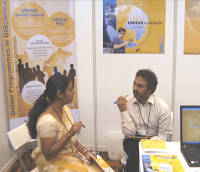
Expanded UNIGIS presence across Asia
At this year’s MapAsia conference in Kuala Lumpur, UNIGIS regional director Dr Shahnawaz had the opportunity to present postgraduate distance education as an innovative option for professional and personal development to delegates from a range of disciplines and backgrounds. Interest in pursuing continuing education in GIScience and GIS was intense, demonstrating accelerated growth across the GIS industry! Ms. Norizah Kamarudin, Junior Faculty and PhD candidate at the Department of Forestry, University Putra Malaysia was welcoming visitors at the UNIGIS exhibition booth. On the closing day of MapAsia, Prof Josef Strobl keynoted and chaired the Capacity Building Forum, a key platform for …
Read more…
UNIGIS Netherlands Conference
UNIGIS Amsterdam is again inviting to the annual UNIGIS conference, June 14-18. The conference program includes multiple workshops on topics ranging from Spatial Analysis: a case study on malaria to Analysing & explaining land use change and will conclude with an Alumni Day on June 18 themed ‘Risk Assessment & GIS’.The opening lecture will be given by Prof Henk Scholten, the UNIGIS Amsterdam program director. While time has been set aside to watch soccer World Championship matches, numerous presentations and activities will introduce participants to the hot topics in today’s world of GIS.Wishing everybody a successful conference and reunion!
Read more… Previous Next