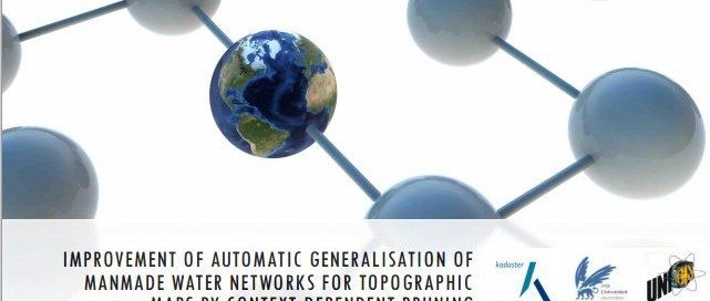
Shared 1st place: Vincent van Altena – UNIGIS Amsterdam
Improvement of automatic generalization of manmade water networks for topographic maps by context-dependent pruning
Read more…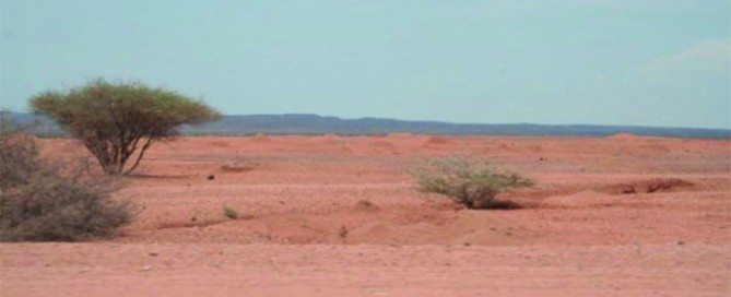
Webinar 31 May | Assessing Land Degradation and Desertification
Dr Elias Symeonakis, Senior Lecturer Manchester Metropolitan University & UNIGIS UK Land degradation and desertification has been ranked as a major environmental and social issue for the coming decades. Thus, the observation and early detection of degradation is a primary objective for a number of scientific and policy organisations, with remote sensing methods being a candidate choice for the development of monitoring systems. This webinar reviews the statistical and ecological frameworks of assessing land degradation and desertification using vegetation index data. The development of multi-temporal analysis as a desertification assessment technique is reviewed, with a focus on how current practice has …
Read more…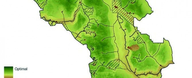
Webinar 25 April | GIS approaches to mapping wilderness
Dr Steve Carver, Senior Lecturer, University of Leeds Throughout early human history, wilderness has been a place of fear and dread, of wild beast and wilder people, often shown on old maps as “Parts Unknown” or “Hic Svnt Dracones” (Here be dragons). More recently these blank spots have acquired a certain romance and the word wilderness has become more closely associated with unspoilt nature and the sublime. In the modern world there are no remaining blank spots on our maps as satellites have surveyed every last inch of the earth’s surface so that all is now “known”. This webinar considers the …
Read more…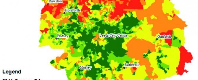
Shared 1st place: Rachel Antcliffe – UNIGIS UK
An evaluation of the Council Tax band as an indicator of household size for small are population estimation
Read more…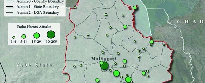
3rd place: Adrianna Valenti – UNIGIS USA
3rd place: Adrianna Valenti – UNIGIS USA
Read more…
Webinar 29 March | Examining the impact of climate change in Tanzania
Rachael Reynolds, Phd Candidate Manchester Metropolitan University Climate is a key determinant affecting a number of disease pathogen life cycles and transmission. Over recent decades, climatically related diseases have shown increasing change in spatial location, both re-emerging in areas and expanding beyond previously known boundaries. Diseases such as Malaria, Chikungunya and Bacterial Meningitis. These changes in location are attributed to a number of factors, but predominantly associated with a mix of social, environmental and climatic changes. The unpredicted change in disease distribution has placed a significant burden upon health systems and available resources, proving particularly high risk in less economically …
Read more…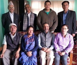
UNIGIS Workshop in Kathmandu!
An intensive workshop with alumni, current students and instructors of UNIGIS@Kathmandu was organised on 13-14 March, 2016 at Kathmandu Forestry College (KAFCOL), Nepal. The workshop focussed on two major objectives: 1. enhancing interaction among the above mentioned three groups for exchanging best practice and experiences for effective online learning, and 2. establishing an effective approach towards writing a high quality Master Thesis. UNIGIS Kathmandu board members Dr. Shahnawaz (Director, UNIGIS S/E Asia) and Dr. Ram Asheshwar Mandal (Coordinator, UNIGIS@Kathmandu) moderated the workshop as well as presented examples of ‘good practice’ from other member within the UNIGIS International network. They also emphasised that …
Read more…
Call to join The Indonesian Peat Prize to establish a national standard for mapping peatlands
The Indonesian Peat Prize is an ambitious, collaborative prize for finding a more accurate, faster and affordable method of mapping the extent and thickness of Indonesian peatlands. A $1 million prize purse will be awarded to the winning team along with their invaluable contributions to establishing a better national standard for mapping peatlands in Indonesia. Students, engineers, consultants, product directors, scientists, research institutions, companies, universities, civil society organizations, non-governmental organizations—anyone with a great idea who meets the criteria is invited to join. People or teams from around the world can join forces with Indonesian partners. The prize is hosted …
Read more…
UNIGIS UK presents new U_Lectures spring 2016
UNIGIS UK has published the new U_Lecture series for the spring 2016 season. Interesting topics and speakers have been selected such as disease ecosystems in Tanzania, mapping wilderness, and assessing land degradation and desertification. In the first U_Lecture on March 29th, Rachael Reynolds shares here insights about examining the impact of climate change upon disease ecosystems in Tanzania. More information about the webinar schedule and registration.
Read more…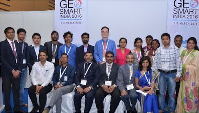
UNIGIS promoting Youth Forum at GSI’2016, Noida!
The UNIGIS@India team led by Dr. Shahnawaz (Director, UNIGIS S/E Asia) played a prominent role in this year’s ‘GeoSmart India’ conference and exhibition held from 1st to 3rd March, 2016 at the India Expo Centre and Mart, Greater Noida, India. UNIGIS coordinated a full day ‘Youth Forum’ on March 2nd, focussing on geospatial capacity building. More than 50 young students and entrepreneurs, eminent academics, prominent industry leaders and successful professionals joined the forum and shared their rich experiences with geospatial education, research, applications and employment opportunities. (The presenters and the prize winners with UNIGIS Team at Youth Forum) UNIGIS has introduced …
Read more… Previous Next