Geographical Informations Systems
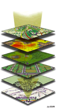
GIS is computer software that links geographic information (where things are) with descriptive information (what things are like). With a paper map “what you see is what you get”, but a GIS-generated map has many layers of information for many ways of thinking about geographic space.
Many companies have database management systems in which day-to-day information is stored. If information has location attached to it (the majority of data are spatial), that information can be mapped. Using GIS, a business can unlock this spatial data and provide the perspective for the analysis needed to succeed.
Whether you look for the closest pharmacy, plan a hiking trip, design a new ski run, or estimate flood damage, this is Geographic Information Science (GISience).
Combination of Geography and Computer Science applied to more than just everyday situations.
GIScience uses GISystems to solve such spatial tasks…

