UNIGIS Fellows & Professor Honorarius

/UNIGIS Fellows & Professor Honorarius

UNIGIS International Fellow & Professor Honorarius

UNIGIS Professor Honorarius and UNIGIS International Fellow is a distinction awarded by the UNIGIS International Association for UNIGIS faculty with an outstanding role on an international level within UNIGIS.


UNIGIS Professor Honorarius

Prof. Henk Scholten
Prof. Henk Scholten
Henk was one of the original founders of the UNIGIS initiative in the early 1990ies, playing a key role in bringing together educational innovators and geospatial researchers from Amsterdam with partners from Manchester and Salzburg. He served as Chair of the international UNIGIS network from 2000, under his tenure several key initiatives were launched which secured the leadership and worldwide recognition of this unique educational programme. Henk is known for surprising his peers by showcasing innovations which first look like ‚wild ideas‘, but immediately are demonstrated to already successfully work as implemented prototypes or applications. This ‚thinking ahead‘ of the current state of the art is not only a sign of thought leadership, but also of an innovative spirit unencumbered by apparent constraints or limitations.
Prof. Tom Poiker
Prof. Tom Poiker
Thomas Poiker had played an important role in educational innovation: already in the 1990ies he joined the UNIGIS distance learning network of universities as its first North American partner, where he is remembered for introducing ‘collaborative assignments’ fostering teamwork long before the days of the MOOC, and for his dedication to individually advising students.

Thomas Poiker received his Ph.D. in Theoretical Economic Geography in 1966 from Heidelberg, and then joined Simon Fraser University’s Geography department in 1967. He quickly became interested in the emerging fields of computer cartography and Geographic Information Systems (GIS) and became one of the pioneers in GIS research. He has published widely on GIS methods, and held a joint appointment with Computer Science. In addition to GIS, ‘Tom’ also taught economic and quantitative geography and cartography.
Prof. James Petch
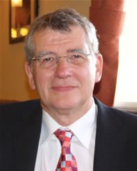
Prof. James Petch
Jim was one of the team that founded UNIGIS in the UK in 1990 and was the first Director of UNIGIS International from 1993 until 2000. He authored original modules on Concepts of GIS, on Data Quality, on Visualisation and, with Mel Woodcock, two modules on Project Management. Jim co-authored with Derek Reeve, GIS, Organisations and People (Taylor and Francis, 1999). He has had a lead role in many GI and GI Education projects with UNIGIS partners over twenty years. He was awarded UNIGIS Professor Honorarius in 2005.
Prof. Derek Reeve
Prof. Derek ReeveDepartment of Informatics, University of Huddersfield
Derek was a founder of the UNIGIS project, having contributed to UNIGIS since its inception in the UK in 1990 until his retirement in 2010. He wrote the ‘Database Theory’; ‘Databases for Enterprise GIS; ‘Internet GIS’ and ‘GIS and Organisations’ modules for the UNIGIS UK diploma, which then provided a basis for similar modules developed across the UNIGIS International programme. He co-authored, with Jim Petch, GIS, Organisations and People (Taylor and Francis, 1999), a text that drew upon material initially developed for UNIGIS. He was awarded UNIGIS Professor Honorarius in 2011.

UNIGIS Fellows

Ian Heywood
Ian Heywood
Ian had been involved in key capacities with UNIGIS UK (Manchester) and UNIGIS International since its inception, and always played an important role as an innovator contributing many key concepts & strategies to the development of this still-unique international network of universities dedicated to online distance learning in Geoinformatics.

These days, Ian Heywood collaborates with several UNIGIS partners on developing and delivering learning experiences on ‘Geo-Entrepreneurship’, enhancing the connections between academic education and business practice. We all are looking forward to the results of this initiative, and maybe even a few more startup companies!
Ann Olivier
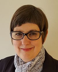
Ann Olivier
Over many years and through many structural changes, Ann Olivier was recognized as the ‘heart and soul’ of UNIGIS in South Africa. Numerous students owe their successful graduation to the motivation and support provided throughout their study program, and beyond: many successful geospatial careers would not have been possible without Ann’s unwavering mentorship.

Ann Olivier, after closure of the formal UNIGIS Sub-Saharan Africa presence, still works with students from the region registered at European partner universities towards their graduation. Her impact on and contribution to geospatial capacity building in this region cannot be underestimated!
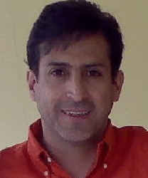
Rafael Beltran Ramallo
Rafael Beltran RamalloUNIGIS Instructor and Consultant
Above and beyond his roles as an instructor and consultant for the UNIGIS Latin America programs, Rafael Beltran is a highly visible and acknowledged ambassador for UNIGIS and contributes through his active social media presence.
Gerhard Belina
Gerhard BelinaSenior Consultant and Lecturer
His merits are in the area of high level consulting, learning materials development and instruction for German, English and Spanish language UNIGIS learning materials. He has been serving as a UNIGIS instructor in the areas of DBMS, distributed architectures etc., and is a lecturer for the same subjects at the University of Salzburg and FH Carinthia. After his studies in Innsbruck, Salzburg and San Diego he had a distinguished career with Intergraph and now is an independent consultant working primarily with European and other international institutions. [2009]