
u_Lecture Nov 9: Smart City Information Modeling and Interoperability
Upcoming: u_Lecture ‘Smart City Information Modelling and Interoperability’ Dr Martin Huber, Condesys Consulting Wed, Nov 9, 2016 5:00 PM – 6:30 PM CET Using a tool called ‘Geographic Information System’ one would expect to get support to model, analyse and control the dynamic phenomena of a geographic region like a city or a country. The mainstream GIS technology delivered in the last 20 years, however, does hardly live up to this expectation. The information concept of GIS is map-centric and maps are static by nature. Information, on the other hand, is a dynamic piece of knowledge exchanged between different actors …
Read more…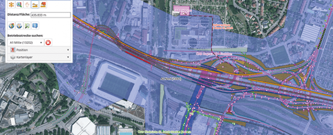
November 9 | U_lecture webinar Smart City Information Modeling
November 9 | U_Lecture ‘Smart City Information Modelling and Interoperability’ Dr Martin Huber, Condesys Consulting Wed, Nov 9, 2016 5:00 PM – 6:30 PM CET Using a tool called ‘Geographic Information System’ one would expect to get support to model, analyse and control the dynamic phenomena of a geographic region like a city or a country. The mainstream GIS technology delivered in the last 20 years, however, does hardly live up to this expectation. The information concept of GIS is map-centric and maps are static by nature. Information, on the other hand, is a dynamic piece of knowledge exchanged between different …
Read more…
Winners of the UNIGIS Academic Excellence Prize 2016
The UNIGIS International Association (UIA) announces the winners of its Academic Excellence Prize 2016. The Prize, initiated in 2008, is presented to the students submitting the best (English language) MSc thesis during the academic year and are nominated by their UNIGIS sites. This year the competition was extremely tight with seven excellent high quality MSc theses being shortlisted by the Review Panel. In the end the panel decided to make three awards. The winner of the Academic Excellence Prize for 2016 is Tim Hernon (UNIGIS UK). His thesis showed a novel approach to extract urban land use data from Volunteered Geographic Information (in …
Read more…
3rd place: Irene Fellner – UNIGIS Salzburg
Irene Fellner (UNIGIS Salzburg) is awarded the third place. In her thesis she presents an innovative way to implement the concept of landmarks in indoor navigation, using a case study at the Vienna University of Economics and Business Administration campus. You can read her thesis here.
Read more…
Workshop: Geo-Entrepreneurship – Using Location to Enhance Your Competitive Advantage
Build up your skills to bring your Geo-idea to the market! In this 1.5 day workshop you will be introduced to a range of techniques used by ‘startups’ to help develop your own geo-enabled business idea. You will learn the steps you need to take to identify and develop your idea, secure customers, and find market opportunities. The participants of this workshop will be GI professionals, UNIGIS/Geo- students and alumni who want to bring their own GI-project to life, or get a new business idea off the ground. These are not only skills for new entrepreneurs, they will help you …
Read more…
November 1-2 GeoDesign Summit Europe | Intercontinental Geodesign
November 1-2 GeoDesign Summit Europe | Intercontinental Geodesign The 4th edition of the GeoDesign Summit Europe is held in picturesque Delft with the TU Delft as the local host. Participants will explore together how they, as geodesign professionals, can incorporate GIS into their discipline to build safer, smarter, and more resilient communities. The motto of this year’s event, ‘Intercontinental Geodesign’, will emphasize that geodesign as a tool for collaborative planning and design works across scales, disciplines and continents to find solutions that improve our living environment. Facing global challenges as climate change and overpopulation but helped by modern ways of communication and collaboration, …
Read more…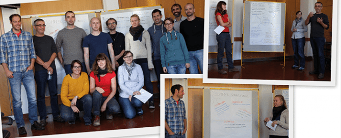
Future GIS Professionals Meeting in Salzburg
Future GIS Professionals Meeting in Salzburg Professor Strobl and the UNIGIS Professional team had the pleasure to welcome future GIS professionals in Salzburg last weekend. The highly motivated group gathered primarily to get to know each other and the UNIGIS team, but also to get in touch with the study materials and to learn about the various opportunities for specialisation in their UNIGIS professional study program. Once again it became obvious that GIS skills are required in a vast number of disciplines. The diversity of domains that were represented in the introductory workshop was large: from GIS professionals in a …
Read more…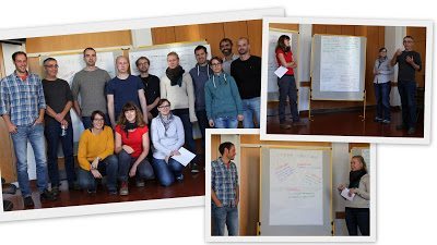
Future GIS Professionals Meeting in Salzburg
Professor Strobl and the UNIGIS Professional team had the pleasure to welcome future GIS professionals in Salzburg last weekend. The highly motivated group gathered primarily to get to know each other and the UNIGIS team, but also to get in touch with the study materials and to learn about the various opportunities for specialisation in their UNIGIS professional study program. Once again it became obvious that GIS skills are required in a vast number of disciplines. The diversity of domains that were represented in the introductory workshop was large: from GIS professionals in a military context to urbanists and from …
Read more…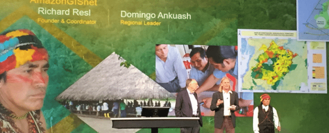
Top award for UNIGIS América Latina Director Richard Resl
Top award for UNIGIS América Latina Director Richard Resl Domingo’s present to Jack Dangermond: ‘maps serving as our spears’ During the plenary session of this year’s Esri User Conference (see link at bottom for bilingual slides), Richard Resl and Domingo Ankuash received the ‘Making a Difference’ award from Esri’s Jack Dangermond. This distinction highlights their work towards preserving Amazonian Indians’ land rights and livelihoods. Through the AmazonGISnet initiative the territories of indigenous groups are documented to preserve this native and pristine environment for their next generations. After being applauded by the 15000 strong audience for their impressive talk, Domingo presented a …
Read more…
50th workshop at UNIGIS Kraków, Poland
50th workshop at UNIGIS Kraków, Poland In the middle of June students of intake 2015 together with the organizers celebrated the 50th workshop in the history of Postgraduate Studies in Geographic Information Systems UNIGIS at Jagiellonian University in Kraków. After regular classes on GPS data collection in laboratories and in the field, students and teachers gathered in the social room of the Institute of Geography and Spatial Management JU. A speech of the programme director prof. Jacek Kozak opened the meeting, then students and teachers tasted cake and strawberries, that accompanied informal consultations. With this significant anniversary we started next …
Read more… Previous Next